Wednesday 1st November to Wednesday 22nd November 2023
(Warning: this a long post. Grab yourself a drink before sitting back to share in our latest journey.)
There are three significant peninsulas along the South Australian Coast. The most westerly and largest is the the Eyre Peninsula between Ceduna and Port Augusta (named after explorer Edward John Eyre). Next and second largest is the Yorke Peninsula, south of Port Augusta (named by Matthew Flinders on March 30, 1802, after the Right Honourable Charles Phillip Yorke). The smallest of the three is the Fleurieu Peninsula south of Adelaide (named after Charles Pierre Claret de Fleurieu, the French explorer and hydrographer, by the French explorer Nicolas Baudin as he explored the south coast of Australia in 1802).
The Eyre was the first peninsula we reached, but having circumnavigated it in 2020, we had planned to bypass it, but with Henrietta in disparate need of a service and new rear tyres we stopped in at Streaky Bay on the west coast for a few days to get the work done.
With Henrietta feeling better we made a b-line for Port Augusta, then south to the Yorke Peninsula. However, Henrietta wasn’t feeling too well after all, having difficulty staying in the lane. We did manage to sort the problem out, but not before travelling 1,400 nerve wracking kms.
We made one overnight stop before reaching Kadina at the northern end of the Yorke. We spent nine days on the Yorke and divided our time across 6 campsites, although two were just one-nighters on friends driveways. We zig-zagged across the peninsula over those nine days and reckon we got a pretty good feel for it, despite missing fifty percent of its east coast.
From the Yorke, it was off to the Fleurieu, also for nine days, planning to camp at three locations for three days each from which we would do day trips to cover the extent of this peninsula. Our first camp was at Christie’s Beach, just 30km south of Adelaide. Next, we planned to go to Rapid Bay on the southern end of the peninsula. However it was booked out , so we opted for Mount Compass in the centre of the peninsula. The weather forecast at our third campsite, Goolwa on the western coast, was diabolical with winds expected to exceed 45 kph with gusts exceeding 60 kph over the three days. We were very happy with our campsite at Mt Compass, so extended our stay there to six nights, with winds only forecast to reach the mid thirties. Despite the better forecast, we stayed indoors on our last day, as it was too unpleasant to travel and sightsee anywhere.
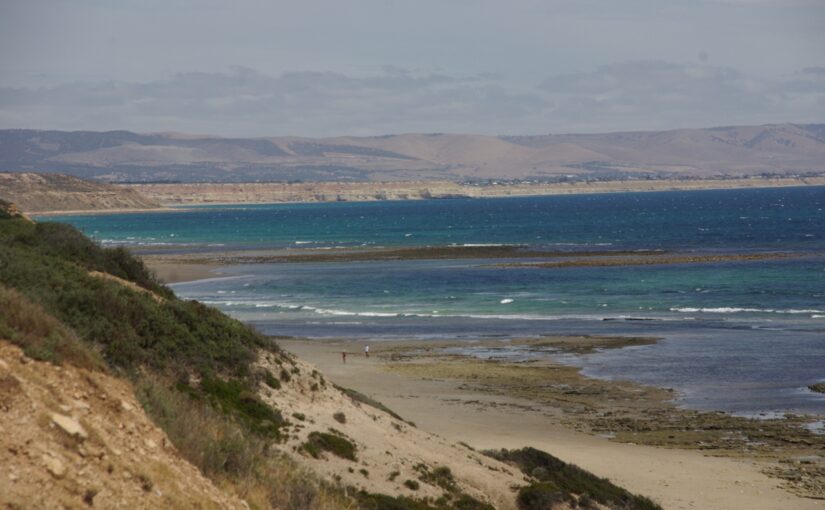
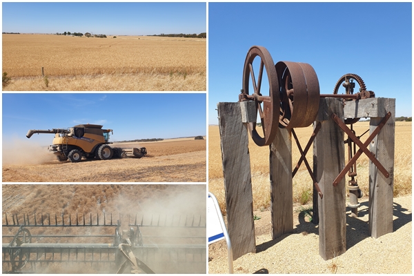
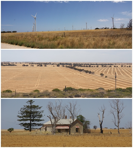
What was our take-away from the peninsulas? Firstly, they are all quite different, but with a few similarities. They were all very dry. They are surrounded by pristine waters. The weather was windy most days, with temperatures in the low 20s. Many beaches on the Yorke were edged with rocks, so access to the water was difficult. The shore into the water was predominantly very flat, so at most tides you’d need to walk several hundred metres for the water to get above your knees. Both the Eyre and the Yorke were predominantly flat, with broad acre crops dominating the landscape. This was particularly the case for the Yorke, with wheat, barley, lentils and canola all ready for harvest, stretching from coast to coast. The Yorke also has an abundance of timber jetties, with one at most of its coastal towns. The Fleurieu, however, is quite different with hills, often steep, making this peninsula more suited to grazing. The Fleurieu was also the greenest and our favourite of the three peninsulas.
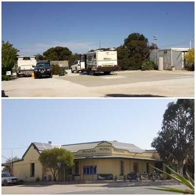
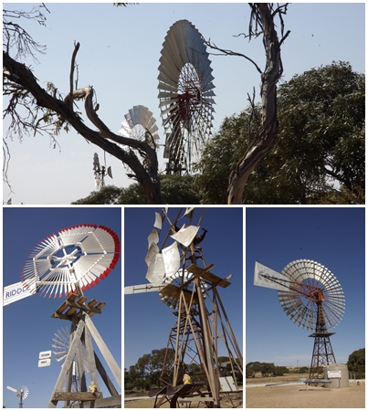
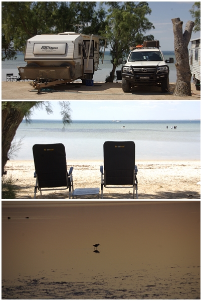
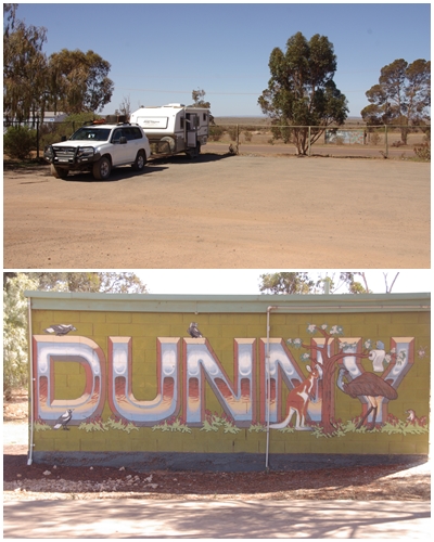
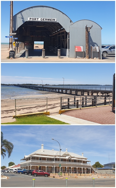
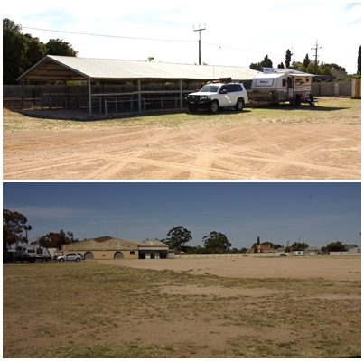
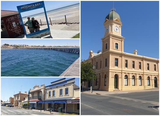
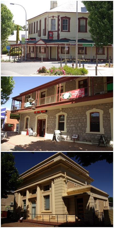
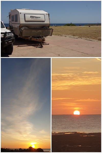
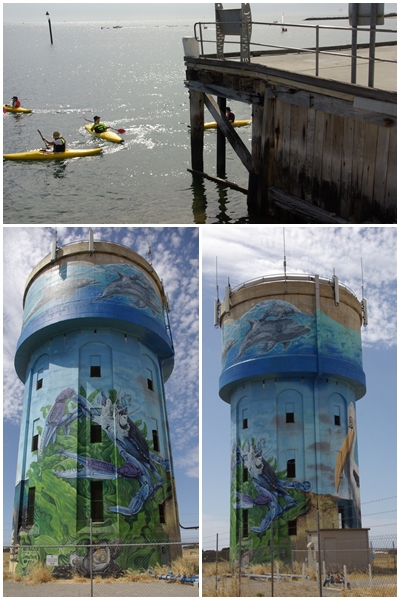
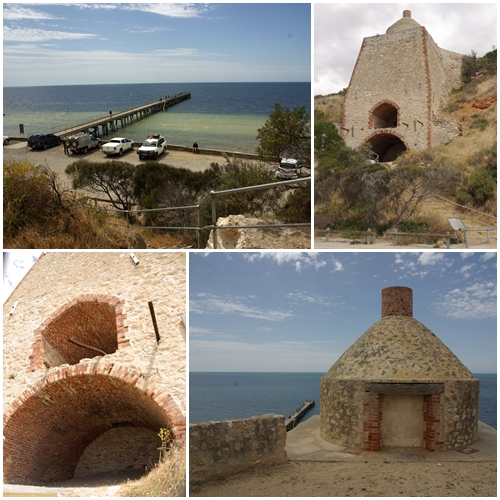
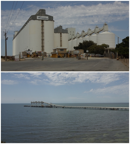
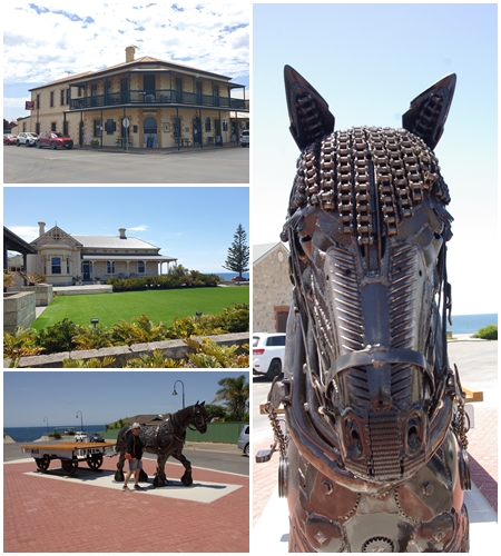
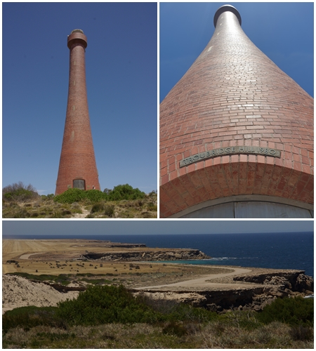
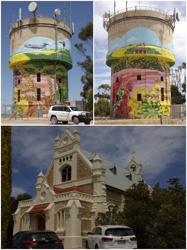
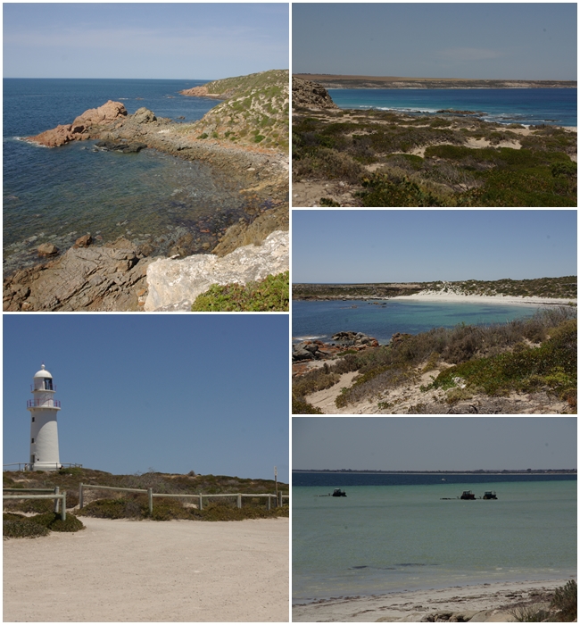
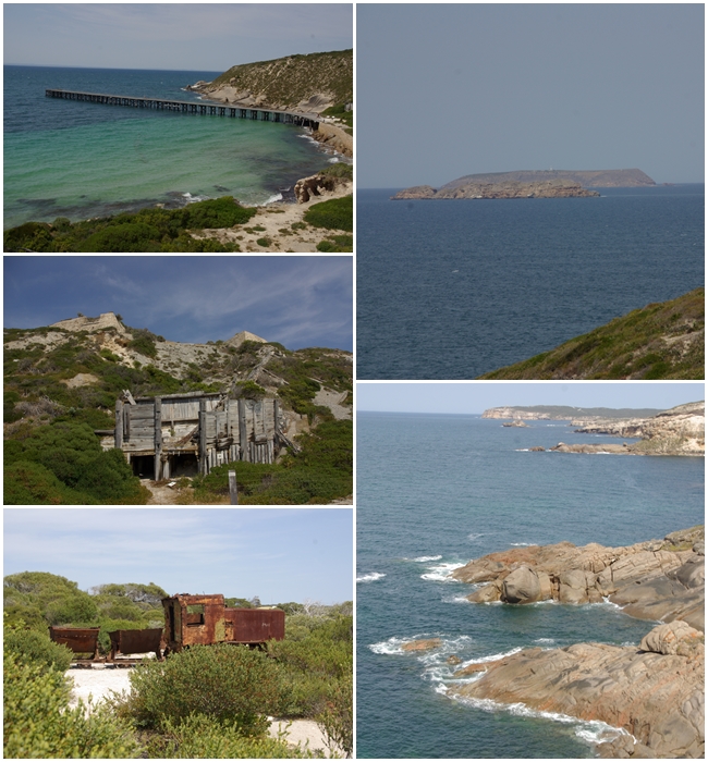
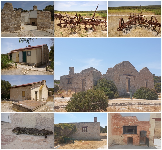
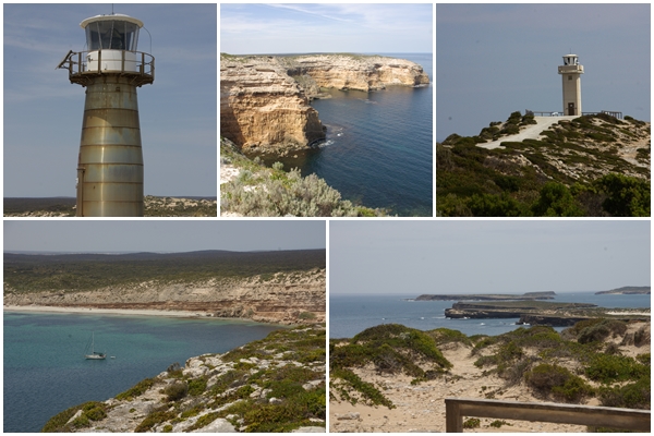
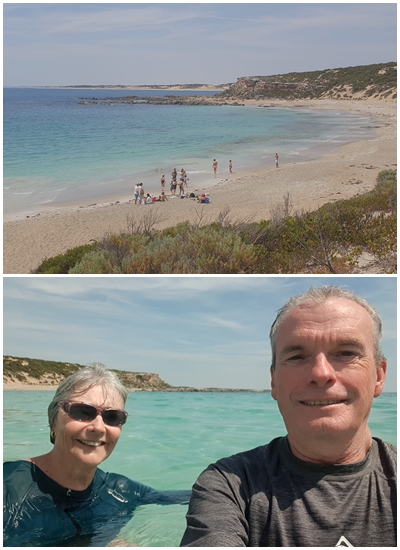
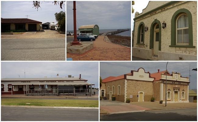
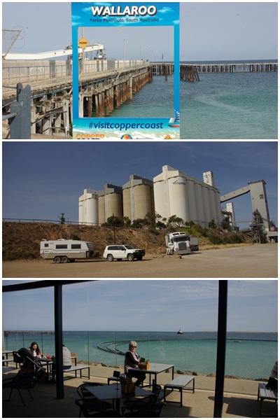
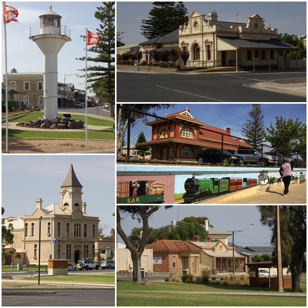
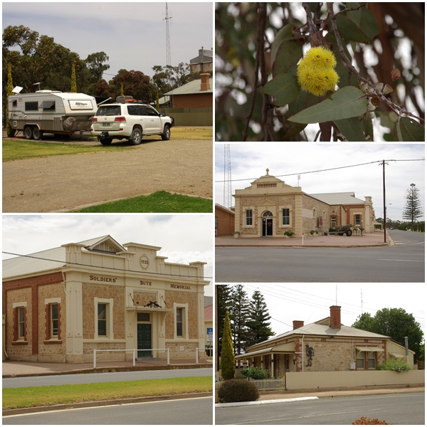
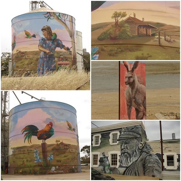
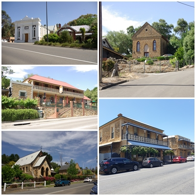
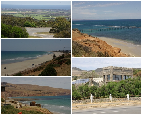
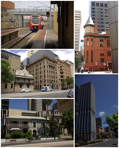
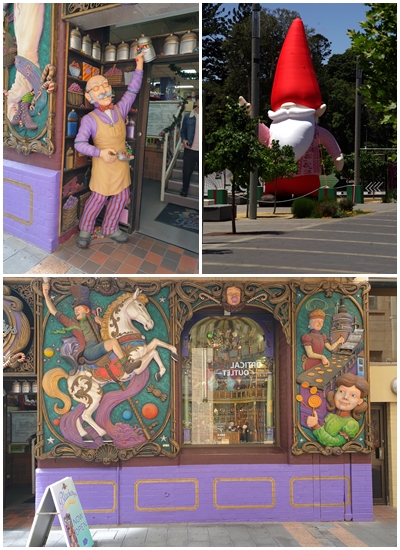
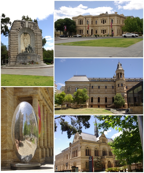
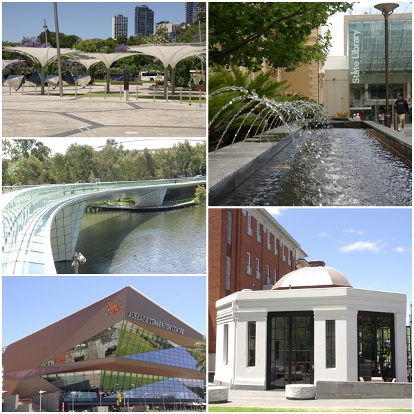
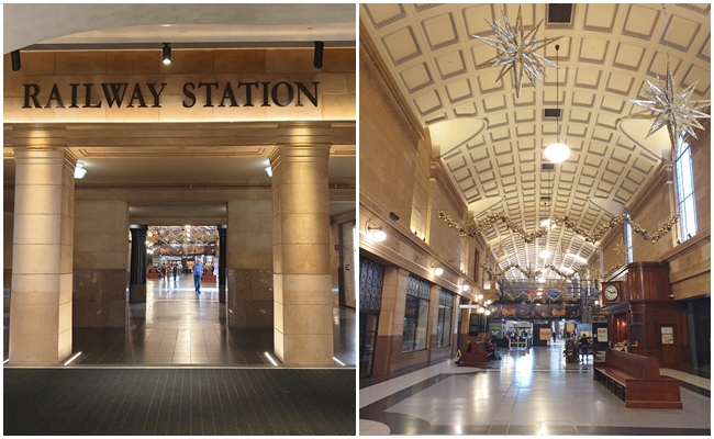
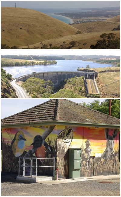
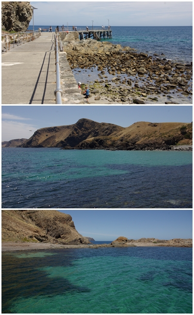
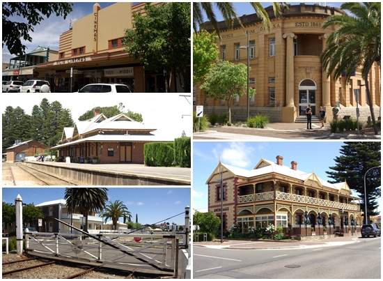
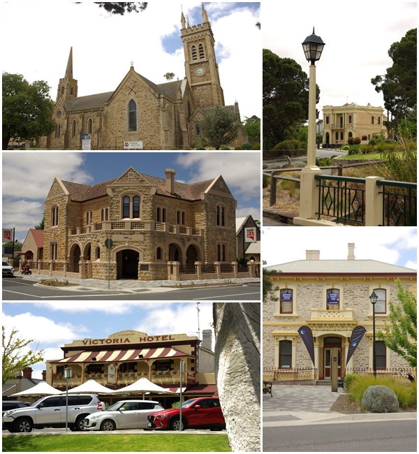
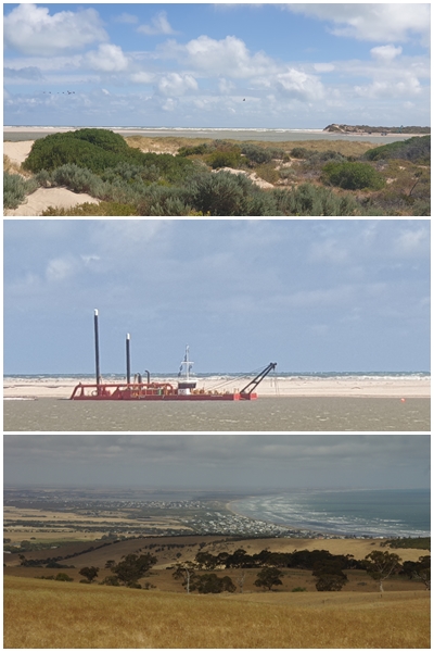
Our first camp after leaving Maralinga was Penong, a quaint little town west of Ceduna. We had planned to travel further, but when fuelling up at the eastern end of the Nullabor we found we had a strong head-wind, so decided to stop at Penong. Having stayed there in 2020, we knew it was a nice little van park.One claim to fame in Penong is its collection of windmills, one of which, a Comet named Bruce, is the largest windmill in Australia. Yum Yum was fascinated and enjoyed sitting on two of the smaller windmills.Our site at the Streaky Bay Foreshore Caravan Park gave us lovely views of the bay, but a long walk was required to find water deep enough in which to swim. We managed to catch up with some local BOG friends, Lloyd and Heather, whist we were there.A quick overnight stay at Iron Knob on the eastern side of the Eyre. We have stayed there a few times. Despite having built new toilets since our last stay, they have retained the old Dunny!460 km east of Streaky Bay is Port Germein, on the Yorke Peninsula (top two photos). Whilst we were having some morning tea overlooking the jetty, a lady came up to us to chat about our Bushtracker. She advised us that her parents owned one. When questioned, she said they were Lloyd and Heather from Streaky Bay. It’s a big country, but a small world. A little further south we stopped and strolled through Port Broughton, with its magnificent Broughton Hotel.Our first two nights on the Yorke were spent at the Kadina Showgrounds. Not a particularly picturesque location, but with only three campers it was pretty quiet and was a good launching site for looking around the northern end of the peninsula.I have a soft spot for old buildings. These are some of the ones in Kadina.120 km southwest of Kadina is the town of Moonta (bottom and right), and nearby Moonta Bay.As we made our way south towards our next camp we stopped off at the inland town of Maitland, proclaimed in 1872. Old buildings included the Maitland Hotel (1874), the Yorke Valley Hotel (1877) and the Bank SA building (1928).BOG friends who live in Minlaton, south of Maitland, have retired from farming but retain ownership of much of their land, which they now lease to Adam who grows wheat (top left), barley, lentils (middle and bottom left) and canola. Adam allowed me to ride with him as he harvested lentils. A fascinating experience. Between Maitland and Minlaton is a display of the now abandoned Yorke Valley Dam, constructed in 1886 to collect rainwater for the peninsula, as no rivers or reservoirs exist. The bore head pictured was drilled to a depth of 126m. Powered by a 12 horsepower Blackstone engine, the resulting water was very salty, being then carted by horse and wagon to nearby dams where it was blended with fresh water. The Yorke Peninsula was connected by pipeline to the Murray River in the 1950s.Our second camp on the Yorke was at Port Minlacowie. Nothing of the port remains. The camp is one of about nine managed by the Yorke Council. They have very limited facilities. Fortunately this one had a relatively new long-drop toilet, and an old building slab enabled us to stay off the dry, burred grass. It was too cold and windy to bother having a swim.From Port Minlacowie camp we explored much of the east coast including Port Vincent with a school group in kayaks and sail boats, and Stansbury with its water tower murals. The standout for us in Stansbury was the worst coffee we have ever bought. We both watered the grass with the coffee as it was too awful to drink.Our exploration also took us past the Wool Bay lime kilns. Built between 1900 and 1910, the kiln was used to burn lime to be used as building mortar, and was exported from the jetty to Adelaide. The kiln was not a success due to problems resulting from its cliff top location and wind variations.Four km south of Wool Bay is the Port Giles Viterra grain handling facility, opened in May 1970, able to load 800 tons of grain per hour.We stopped for lunch at the Edithburgh Hotel. Edithburgh is a small town on the east coast, with a jetty, as do most towns, and a new attraction being a full size steel Clydesdale horse in the main street, erected to coincide with the jetty’s 150th anniversary, which was restored for the anniversary.The Yorke Peninsula has plenty of wind, wheat and worn-out farm structures.On the south eastern corner of the Yorke stands the Troubridge Hill Lighthouse. Built in 1980 it is one of only a handful of brick lighthouses in Australia. What is unique about Troubridge is that the special wedge shaped clay bricks have not been rendered or painted.On our return trip to camp we passed through Yorketown, with its water tower mural and elegant St Columba’s church.The following day we moved camp to the little town of Warooka, which provided an inexpensive camp site at the rear of the bowlo (no pics unfortunately). After setting up camp we explored the northern coast of the peninsula’s “foot”, taking in the towns of Corny Point (pictured), Port Turton and Point Souttar as well as Burners Beach, Dunn Point and Gleesons landing. All too cold for a swim.On our second day at Warooka we did the southern coast of the “foot” from Sturt Bay to Marion Bay and into the Innes National Park. The Stenhouse Bay jetty and ruins (left photos) are the remnants of a Gypsum plant, with gypsum coming from the nearby Marion Lake. Commencing in 1934, the works ceased in 1973. The works are now part of the national park.Inneston was a company town of the Yorke Peninsula Plaster Company, with the town existing from 1913 to 1930, when the Great Depression forced the closure of the plaster works. Not much remains, but seven structures have been restored by the national park for use as holiday accommodation.Continuing further into the national park we visited the West Cape lighthouse (top left) and the Cape Spencer lighthouse (top right). The views from West Cape across Pondalowie Bay and the South, Middle and North Islands were spectacular (bottom).Despite the increasing heat, no beach had presented itself as a nice swimming beach until the last beach in the national park, Shell Beach. Beautiful. The water was clear and cold, whilst the sand was almost too hot to walk on. On our return drive to Warooka, the temperature reached 40 degrees.We packed up at Warooka and returned north to Minlaton early to hopefully rectify Henrietta’s drunkenness on the road. We put a new pair of tyres on the front. We then went to the other end of town to spend a night with BOG friends Rob and Glenda, to be joined by other BOG friends Grahame and Nerilee for a wonderful afternoon and evening (top left). After a cooked breakfast with our BOG friends we made a late start towards Moonta Bay, via Port Victoria (other pics) and Port Hughes on the west coast.After a night on the driveway of family friends Nathan and Tia at Moonta Bay, we hitched up and finished our exploration of the Yorke with a visit to Wallaroo, with great views and coffee at the Shores Eatery adjacent to the jetty and grain loading facilities.Walleroo is bursting with beautiful historic buildings.Our next camp was the little inland town of Bute at the very top of the Yorke Peninsula. We stayed just one night in a quaint council run caravan park with only six sites and magnificent yellow-flowering gums. Bute is an aging town, with a few historic buildings remaining.Bute’s main attraction now is the beautiful art on the retired grain silo. Power poles in the town also feature local wildlife, though not to the standard of the silo art. The town of Port Wakefield, just east of the Yorke, sports a magnificent mural on the wall of the Rising Sun Hotel.From Bute we had a relatively short 170km drive south through Adelaide to the west coast of the Fleurieu Peninsula and our camp at the Christie’s Beach caravan park. Not our favoured camp type, but the choices are limited near Adelaide.On our first full day on the Fleurieu Peninsula we toured through the hills south of Adelaide, driving through Happy Valley, Coromandel Valley, Clarendon (all left and top right), Kangarilla, McLaren Flat and McLaren Vale. Stopped for coffee in McLaren Vale but the town (and the coffee) lacked oomph. Then on to Willunga (bottom right), a lovely little town with a great vibe from cafes and cool shops.Continuing our drive from the hills, we joined the west coast at Sellicks Beach and followed “Route 31” along the coastal towns north , back to Christie’s Beach. Too cold and windy to swim anywhere. The unusual castellated house and fence at bottom right is entirely clad with round river rocksOn our third and last day at Christies Beach, we caught the train to Adelaide for a wander around. Many of the preserved historic buildings are dwarfed by the moderns.The front of Blackeby’s Sweets Shop was a sight to behold. We didn’t venture in (need to preserve our teeth). The big jolly red fella can be seen throughout the city.We spent a few fascinating hours in the Adelaide Museum, before wandering up North Terrace past the State Library, Art Gallery and University.After a free bus tour of the city we wandered through the Riverbank Precinct with the Festival Centre and Convention Centre (left photos). Top right is the State Library, bottom right is a café outside the Space Discovery Centre.The entrance to the Adelaide Railway Station from the Riverside Precinct is stunning, as is the interior.We had planned our next camp to be at Rapid Bay near the south end of the Fleurieu. It was booked out so we opted for Mount Compass Caravan Park. Though it is part of the Big 4 chain, it is far removed from that style. No pool, playground or jumping pillow. It is the nicest van park we have every stayed in. And the view from the balcony is awesome, Pity it is too cold and windy to enjoy it for too long. What is wrong with SA’s weather?On our first full day at Mt Compass we took a drive along the western coast of Fleurieu through Myaponga (weird name), past the Myaponga Reservoir, and views to the coast………..continuing along the coast to Second Valley, a lovely protected beach and jetty. Too nice to resist, I took a swim, and it was not too cold at all.The following day we took a drive to Victor Harbour on the peninsula’s west coast. It’s a tourist town, currently set up for schoolies. The iconic horse-drawn tram to Granite Island was not operating, so we settled for a short walk through town past (clockwise from top left) the art-deco Victa Cinema (1923), Bank SA building (1848), the Anchorage Hotel (1905), and the railway station (1926) and hand operated railway gates.Day 5 at Mt Compass we drove to the pretty town of Strathalbyn. Not knowing what to expect of the town it took quite by surprise. A charming town with preserved historic buildings, picturesque park and no less than six antique shops, three of which we checkout out. A bit pricy for our budget, but some wonderful stuff nonetheless.From Strathalbyn we passed through very windy Goolwa and out to the mouth of the river Murray from Hindmarsh Island. Then via a lookout with a great view to the southeast over Goolwa with the Coorong National Park behind.Our journey through the three peninsulas (pale green). The scale of the map makes it impossible to trace all our tracks through the Yorke and especially the Fleurieu Peninsula.
2 thoughts on “The Three Peninsulas”
Thanks for more pictures from SA. We must add Yorke Peninsula to our bucket list.

Thanks for more pictures from SA. We must add Yorke Peninsula to our bucket list.
Hi Graham & Carol, photo’s are amazing as usual.
Enjoy the wedding. Safe travels.