One of Australia’s iconic outback routes, the Oodnadatta Track stretches 620 km from Maree SA in the south, at the junction of the Birdsville Track, to Marla, just south of the NT/SA border, where it joins the Stuart Hwy. The Track follows the route of the Old Ghan Railway, providing an array of historic old bridges and ruined railway buildings to explore along its length.
However, more on the Oodnadatta Track later. It’s been 11 days and 2,150 km since our last post, so there’s a bit to fill you in on.
Whilst at Lake Cargelligo we received a text from our sister-in-law Jane. Having seen our post the night before, it looked like there was a good chance that we’d cross paths, them heading east from WA, and us heading west to WA along the same highway. We met the following night at Balranald, enjoying dinner out together at the local RSL before continuing our journeys the following day. It was a fortunate rendezvous, as it allowed us to offload our fruit to Bob and Jane before passing through the Riverland Quarantine Station a little further west of Balranald.
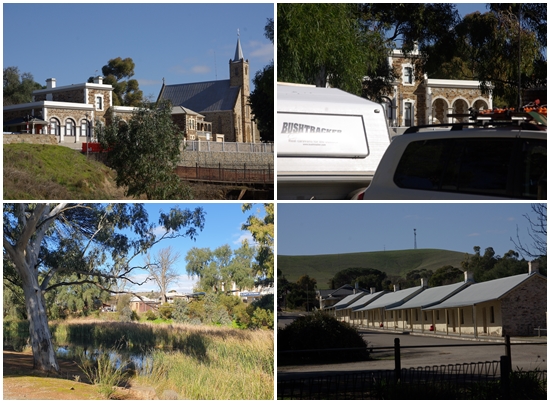
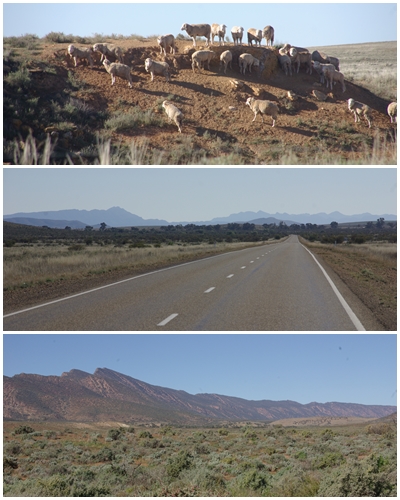
From Balranald we passed quickly through Victoria, taking just a few hours through the north-west corner, and stopping the night at a free camp at the unusually named Devlins Pound, west of Renmark in SA, overlooking the Murray. Our journey then took us to the north west, through the pretty historic township of Burra, then north past the Narien Range and Southern Flinders Ranges.
We had planned to revisit some of the stunning campsites in the Flinders Ranges we had enjoyed in 2018. When considering which campgrounds to choose, we made the decision to skip the Flinders altogether in order to spend more time in WA. However there is one constraint, being the need for internet access on 25 July for a BOG Zoom meeting. We’ll be at Uluru, and head west from there into the remote WA wilderness on the 26th.
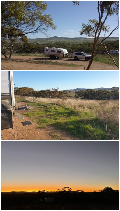
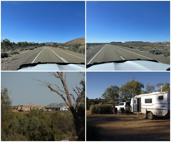
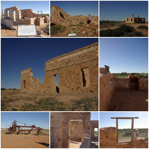
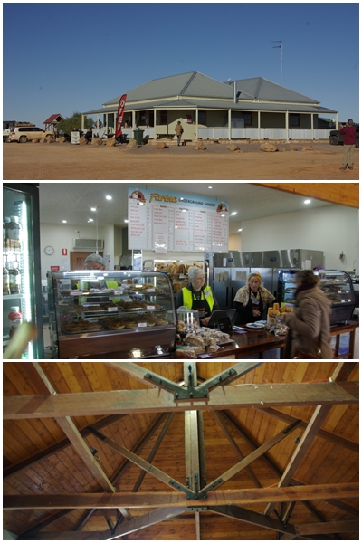
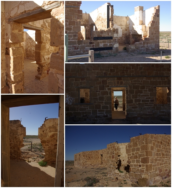
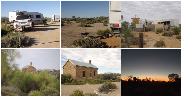
We found a free camp on private property a few km west of Orroroo where we stayed 2 nights, then on to the historic town of Farina for one night, so as to enjoy the famous fresh bread from the underground bakery that is open only for 8 weeks each year. That left us just 54km to reach the start of the Oodnadatta Track at Maree.
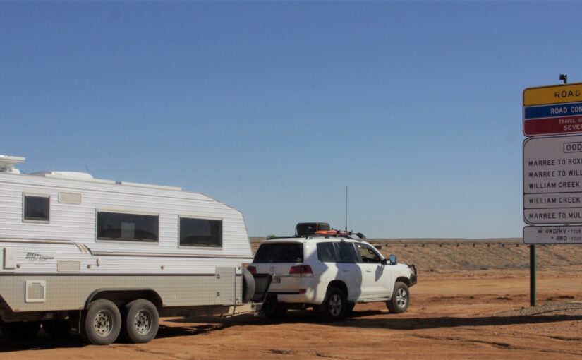
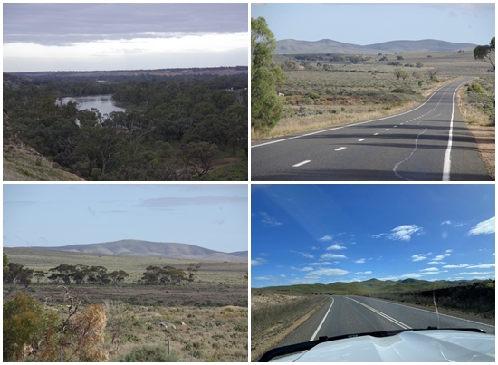
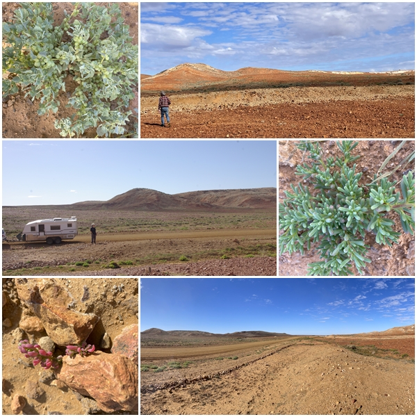
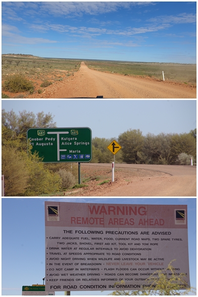
It is a lottery as to how you might find the condition of these outback tracks, all a function of the weather, volume of recent traffic and time since last graded. We won the lottery. Those who had travelled the Track weeks earlier had endured severe rain, rendering the track impassable in places, but as the Track dried, it opened up, and the passing traffic compacted and polished the surface to a nice smooth finish, making for easy travel up to and above 90 kph. By the time we travelled, the surface hadn’t dried out enough to create dust which can then from corrugations, so it was a dream drive for the 200km from Maree to William Ck. The surface was drier north of William Ck to Oodnadatta, another 200km, so some corrugations had formed, but on the most part it was smooth sailing, with some sections being regraded. The final stretch to Marla was very dry but still able to support speeds in excess of 90 kph, with the exception of numerous floodways which were still waterlogged, with only one set of wheel tracks through which to drive, and the typical corrugations as you climb out of the floodway.
Where’s all the wildlife? In 2,150km we have seen 1 dingo, half a dozen emus and half a dozen kangaroo. We assume that with the recent rains they have no need to stay close to the roads for greener feed and water.
Upon reaching Marla at the end of the Oodnadatta Track we reflected on a wonderful and surprisingly easy 600km journey.
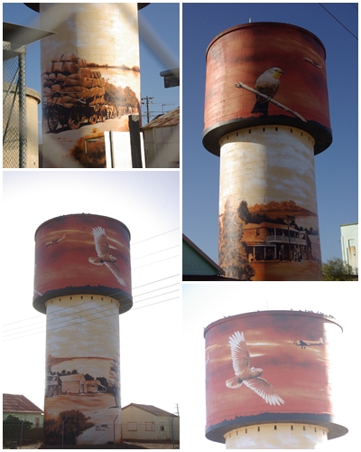
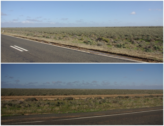
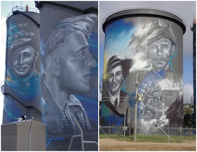
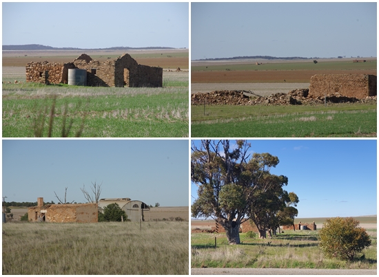
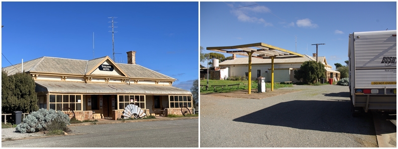
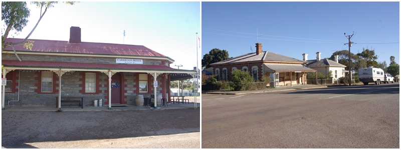
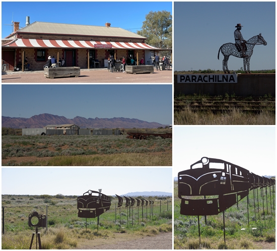
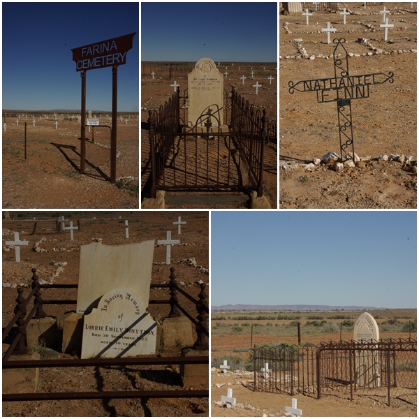
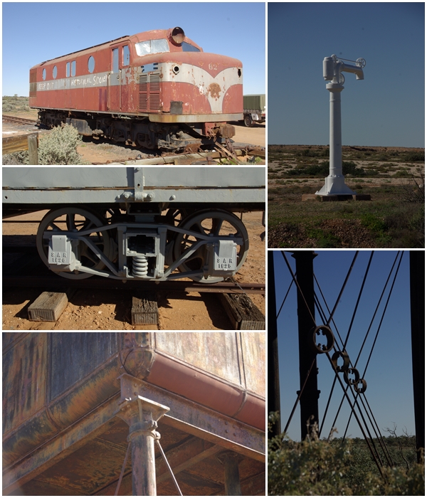
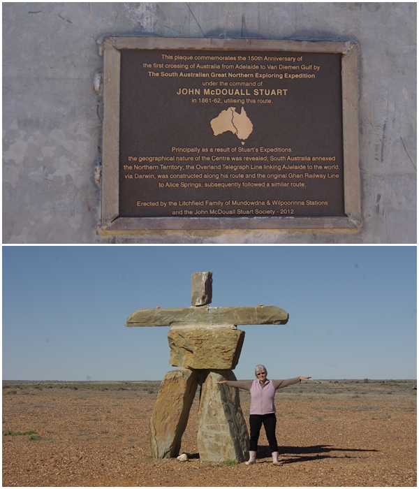
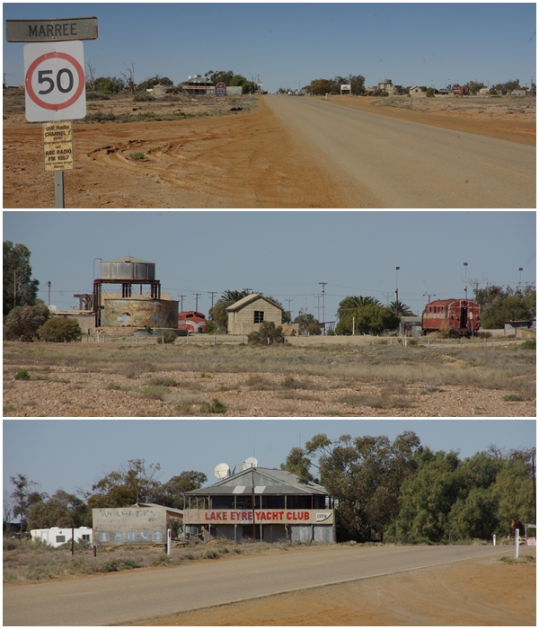
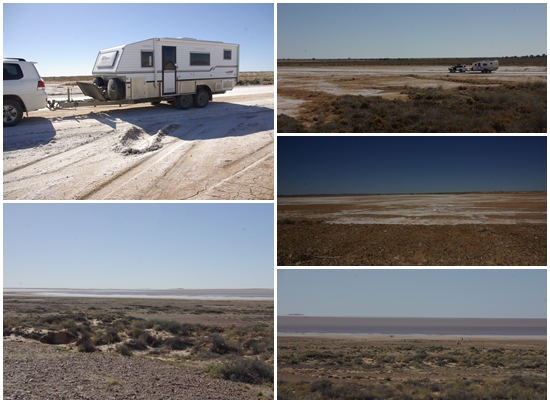
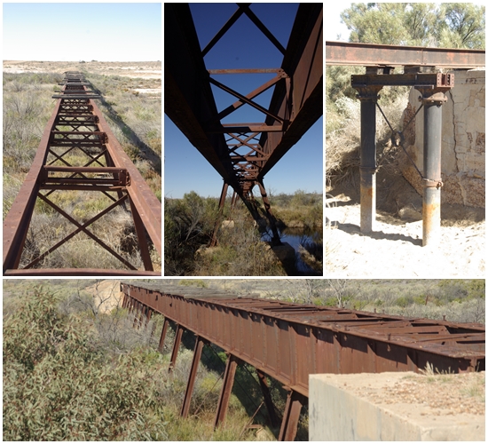
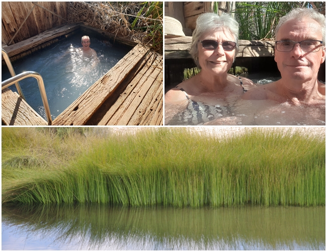
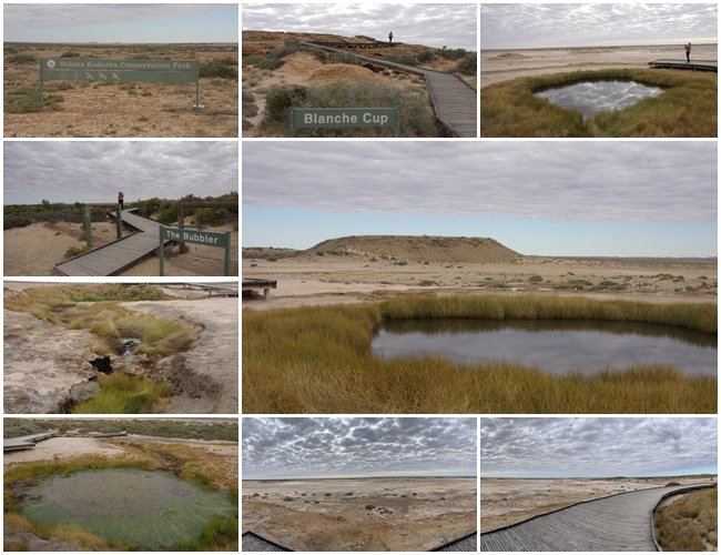
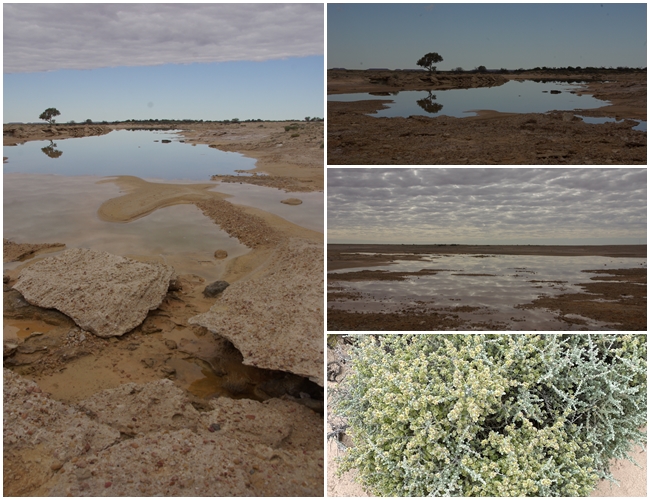
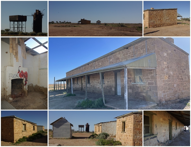
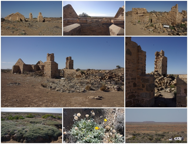
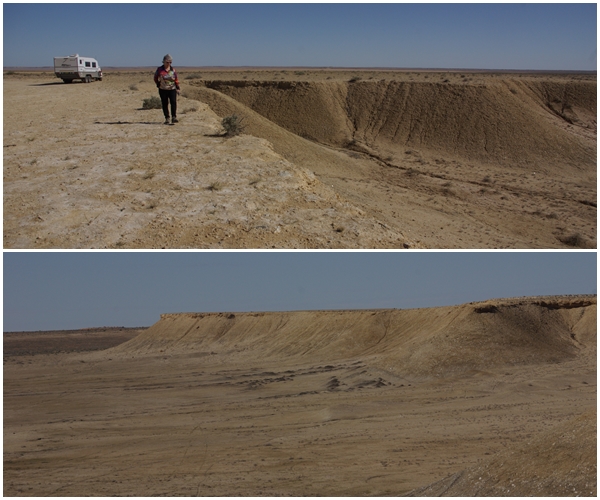
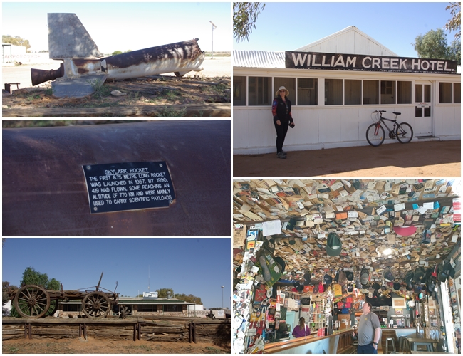
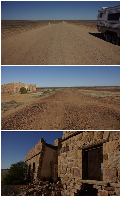
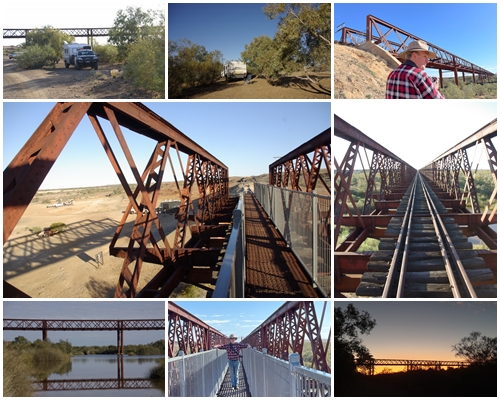
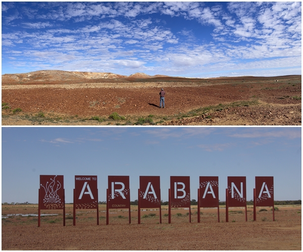
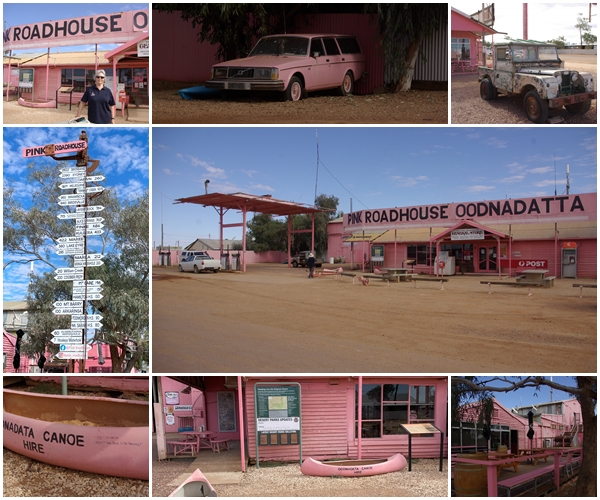
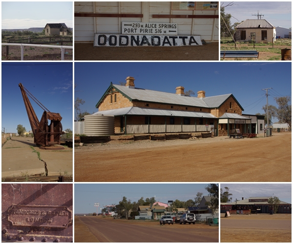
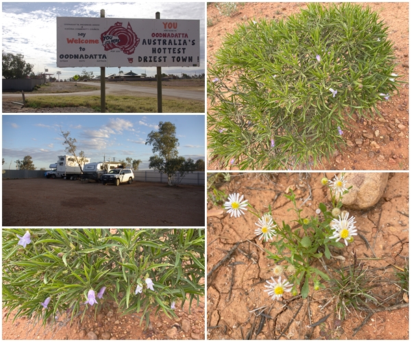
As we left Lake Cargelligo we took a drive past their water tower, adorned with murals depicting their history and nature.It’s plain to see why the Hay Plains are given this name.As we passed through Hay, we stopped for groceries and came across their water tower murals, celebrating “Hay, A Town That Went to War”. The murals depict, from left to right, Private Norman Charles Flack, Private William “George” Cannon, Lieutenant Lorna Margaret Whyte, Private Victor George Murray and Corporal Clifford Leslie Farlow. Of the 300 men from Hay who fought in WWII, more than 50 lost their lives.On the SA side of the Murray River, we stopped one night at Devlins Pound, before driving into the picturesque foothills of the South Flinders Ranges.Having spent several days in the historic copper mining town of Burra in 2018, we only stopped for morning tea this time, but I couldn’t resist taking a few photos of their beautiful buildings on a picture-perfect day.An element of the Southern Flinders Ranges region that has always intrigued and delighted us is the abundance of derelict stone farm buildings littering the landscape.In addition to farm buildings, there are numerous towns throughout the region that have seen better days. This is the Yarcowie Hotel and fuel stop, when ULP was 59 cents per litre.A few km west of Orrooroo, a land owner has opened part of his property to travellers to camp for free. With internet access and magnificent views, we stayed 2 nights.The beautiful Flinders RangesAnother small town fading into oblivion is Carrieton. Does anybody want to buy a hotel?A few km north of the Ikara-Flinders Ranges NP is the small town of Parachilna, with its iconic Prairie Hotel, serving its signature meals of camel, kangaroo and emu. We enjoyed camel sausages and crispy kangaroo tail with bread and dukka. The hotel had closed due to COVID. Fortunately, it has reopened, and has been renovated inside since we were there in 2018.Continuing north, this time on the Outback Way, the landscape changes from the broad sloping ranges of the Flinders, to flat-top mountains called mesas. 53 km before the start of the Oodnadatta Track is the historic town of Farina.Proclaimed on the 21 March 1878, Farina (Latin for flour) was so named in anticipation that the area would be suitable for growing grains. Whilst this ambition wasn’t realised, the town grew to more than 300 inhabitants as the railhead for the Old Ghan railway. Once the railway was relocated to the west, the town diminished, with the last inhabitants leaving in the 1960s.A few grey nomads recognised the historic value of the township, and in 2008, pulled together a band of volunteers to stabilise the buildings that had fallen into ruin to render them safe. They also resurrected the old underground bakery in 2010, built a café and information centre in 2021, and are now doing a roaring trade for the 2 months the facilities are open each year. The ruins are accessible all year.The old Farina cemeteryOnce the railhead of the Old Ghan railway, Farina holds many relics of the era. The locomotive was recently donated by the Peterborough Steamtown Heritage Rail Centre on permanent loan. At great expense to the Farina Restoration Group, it was trucked to the site. The Heritage Centre plan to repaint the loco in its original livery, at the expense of the Farina Group.This plaque commemorates the 150th Anniversary of the first north-south crossing of Australia in 1861-62, under the command of John McDouall Stuart. We have no idea of the significance of the rock man nearby. The north south highway from Port Augusta SA to Darwin is named the Stuart Highway.Leaving Maree behind us as we commence our journey on the Oodnadatta Track.Snow in outback SA? No, just one of the many salt lakes and pans in the region. Afterall, it is below sea-level. The lower 2 photos are of Lake Eyre South. Yes, there is water in the lake.The Oodnadatta Track follows the route of the Old Ghan railway (Great Northern Railway), with many bridges still in place, though near ruin.Not only were there many bridges along the rail line, many fettlers’ cottages were constructed along its length to provide shelter and accommodation for the workers who constructed and maintained the track. This cottage is at Margaret Siding.Coward Springs railway siding, 145 km west of Maree, was opened to rail traffic in 1888. The siding is located near the mound spring named Pitha Kalti Kalti by the local indigenous people, but renamed Coward Spring. A bore was sunk near the siding in 1887, and continues today, after it was recently renovated to reduce its flow. The local hotel (1887-1953) and the artesian pool were popular in their time. The property is now a date farm and offers camping accommodation, which we enjoyed for 2 nights. The stone building, one of 2 remaining, is now a museum.The Coward Springs bore now feeds a smaller pool than that in its heyday, at a comfortable 28 degrees C, which then flows into wetlands.Coward Springs is located in the Wabma Kadarbu Mound Springs Conservation Park. Near Coward Springs are mound springs Blanche Cup and the Bubbler. Mound springs are natural outlets for the waters of the Great Artesian Basin. Most springs occur at the margins of the Basin. The mounds are formed from the precipitation and deposition of salts, minerals, sands and clays over thousands of years as the water reaches the surface.Overflow from the mound springs and some of the succulent vegetation that exists at the springs.Another fettlers cottage and siding infrastructure, this one at the Beresford Siding west of Cowards Springs.The 3,178 km overland telegraph line from Adelaide to Darwin was constructed in 1871 to 1872. Every 250 – 300 km was constructed a repeater station to receive and re-transmit the Morse signals. These are the remains of the Strangways telegraph station located at Strangways Spring. Seven buildings plus a blacksmiths area and stockyards made up the station. The buttressed building with pitched gables was the water tank. The station was closed in 1896, with its operations transferred to nearby William Creek.The stony gibber plateau gives way to erosion with flat-topped hills remaining, called mesas.William Creek, and its hotel, plus the remains of a Skylark rocket, one of 419 launched from the Woomera Rocket Range. Fuel at William Creek cost us $2.99 per litre. William Creek is surrounded by Anna Creek Station (a Kidman property), the world’s largest cattle station, a massive 23,777 square km (5,873,000 acres)Another fettlers cottage on the Great Northern Railway, this one at Peake.One of the largest bridges we came across is the Algebuckina Bridge across the Neales River, 52 km southeast of Oodnadatta. A walkway has been constructed to allow access onto a small section of the bridge. The bridge is also the site of a free camp.The landscape is forever changing.Much of the Oodnadatta Track crosses Arabana Country. An influenza epidemic in 1919 wiped out whole families and groups, especially those living along the railway. The majority of remaining Arabana live in localities such as Maree and Port Augusta.The iconic Pink Roadhouse at Oodnadatta. Lynnie and Adam Plate strolled into Oodnadatta in 1975. After setting up a part-time snack bar in a back street, they realised they needed more exposure and in 1983 moved to the main street and started selling fuel in addition to food. The Pink Roadhouse was then born as a marketing tool, the pink colour borrowed from the Readymix fleet of pink concrete trucks.Surveyed in 1890, Oodnadatta was the railhead from 1897 to 1927. Camel trains left Oodnadatta to supply Alice Springs and remote properties throughout Central Australia. The rail line reached Oodnadatta in January 1891, and was extended to Alice Springs in 1929. The railway was relocated further west in 1980, yet the town lives on, despite the Transcontinental Hotel being closed (bottom right).Bordering the Simpson Desert, Oodnadatta can get rather hot. Our original plan was to stay there for 3 nights, but after seeing the town we decided that one night was sufficient.The end of the road, or Track. The top photo is the Track just 5 minutes before the junction with the Stuart Highway. We didn’t see the warning sign at our start of the Track. Fortunately, we complied with all but one precaution. We only travel with one jack.Our journey described in this post runs from Lake Cargelligo in NSW to Marla in SA, via the lime green line. The Oodnadatta Track goes from Maree to Marla.
One thought on “The Oodnadatta Track”
Great journal of your latest trip. So pleased to see you on the way.
Great journal of your latest trip. So pleased to see you on the way.