When people think of the “Red Centre” I imagine they think of Alice Springs and Ayres Rock (Uluru). Whilst that’s a reasonable assumption, there’s certainly a lot more to be considered.
From the western end of the Oodnadatta Track we turned right at Marla onto the Stuart Hwy and headed north toward the Red Centre. First stop was the Marla Travellers Rest Roadhouse for fuel and a few provisions. At $2.15 per litre it’s the cheapest diesel for a long while. We found a shady park for lunch away from the roadhouse and its madding crowd, then off towards the Northern Territory we went.
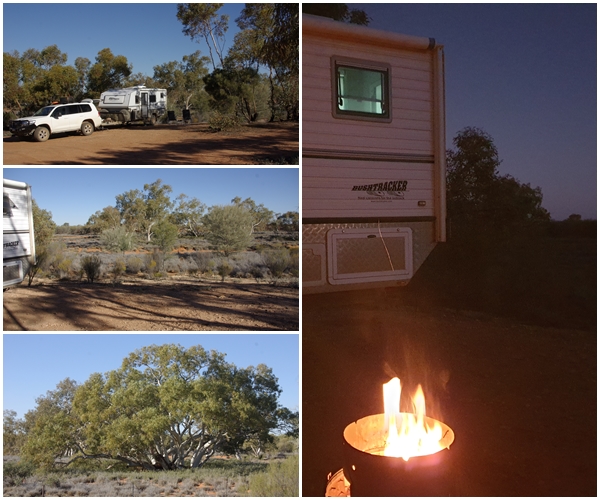
We had booked our camping sites at Uluru and Kata Tjuta (the Olgas) several days earlier, with a few spare days beforehand in the event of a mishap of delays on the Oodnadatta. Fortunately, no such delays occurred, so we had a few days to kill before reaching Uluru. We also couldn’t move our bookings because we had to be certain of internet access on the 25th for a Zoom meeting which we planned to be our last night at Uluru, before we headed further west in the Never Never. 51 km before reaching the SA/NT border we stopped at a free camp at the Agnes Creek rest area. A massive rest area, with heaps of space, so we found a nice location backed onto the babbling Agnes Creek (actually a dry creek bed), and it was so peaceful that we stayed for 3 nights.
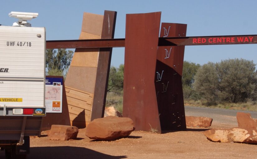
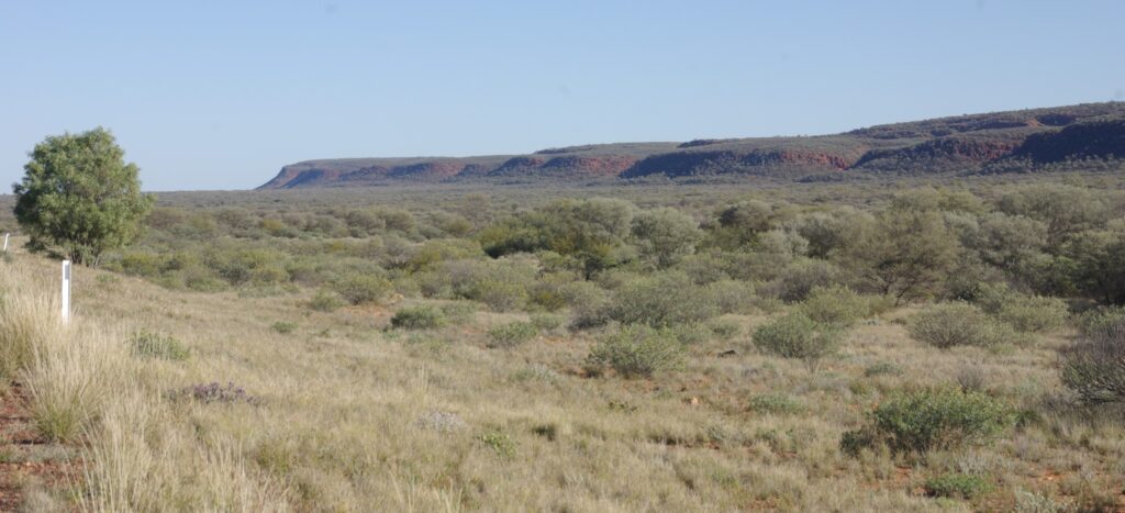
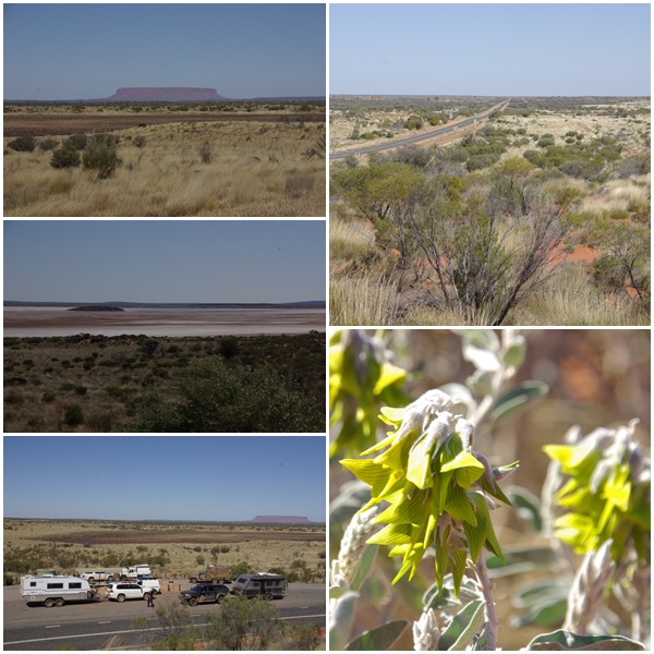
Interestingly, immediately crossing the SA/NT border after leaving Agnes Creek presented a completely different landscape with large rocky outcrops, rather than vast flat plateaus. We only had 92km to travel north from the border before turning west onto the Lasseter Highway at the Eridunda Roadhouse where we fuelled up again (a constant activity). We continued west for 149km before turning north towards Watarrka National Park (Kings Canyon), spending the night at Salt Creek rest area before continuing on to Watarrka the following morning.
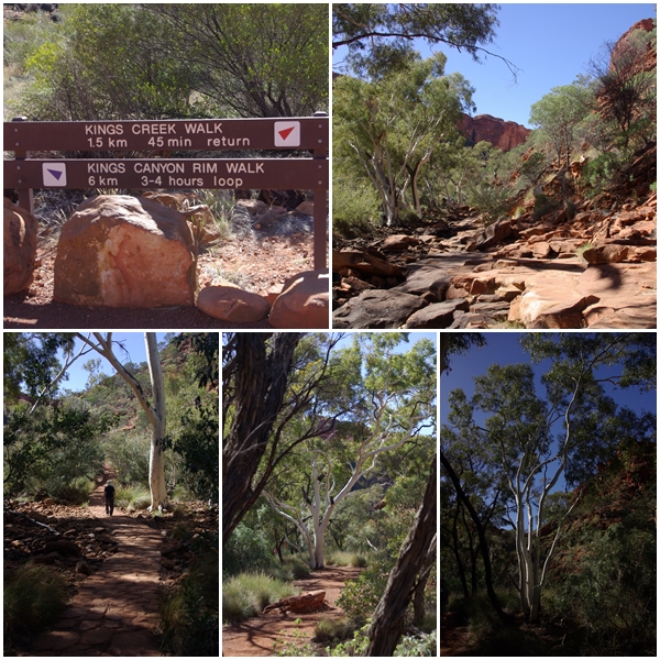
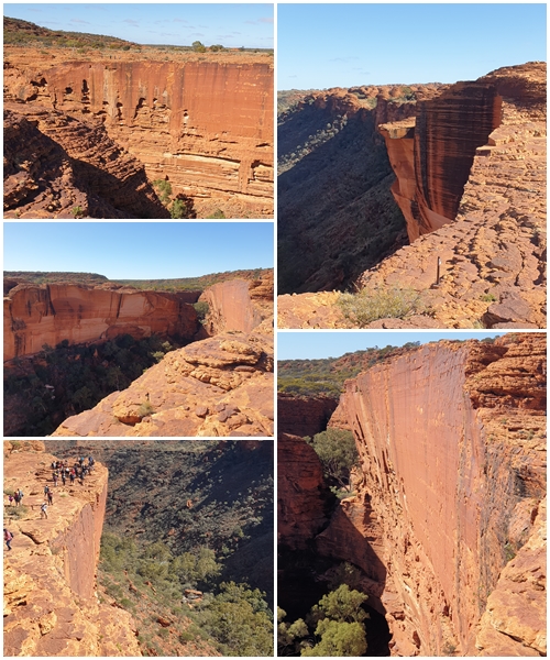
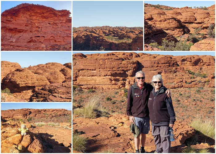
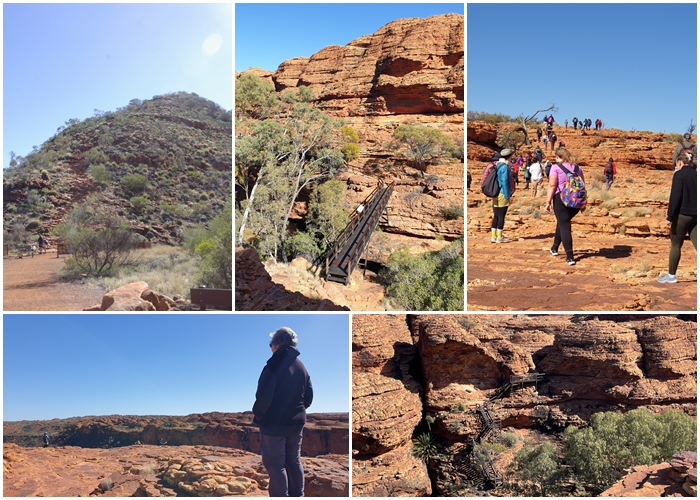
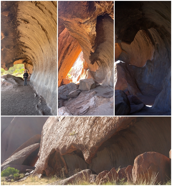
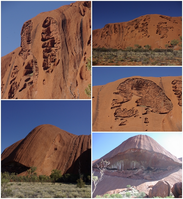
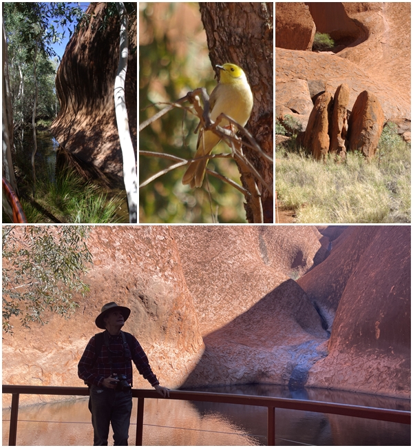
We spend 2 nights at Watarrka in the Discovery caravan park, enjoying the Creek walk into the canyon on our day of arrival, then doing the longer, stunning rim walk on the following day in extremely windy conditions. The next morning we were off again, 304km to Yulara, the accommodation and service town for the Uluru-Kata Tjuta National Park. We spent another 2 nights in a van park, with the remainder of our arrival day spent checking out Yulara and seeing the sunset from a local lookout, rather than driving to the popular touristy sunset site. The next day we had a full day to explore the Rock, doing the 10.6km base walk (probably 12km after you include all the side wanderings). A great way to enjoy the splendour of the Rock, though tiring (it’s been a while since we’ve walked any significant distance).
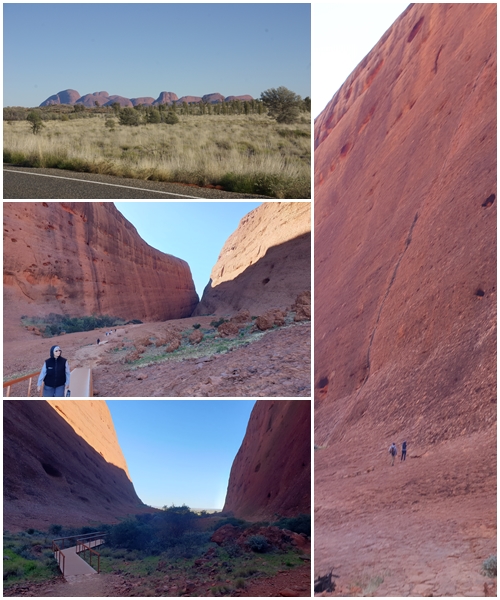
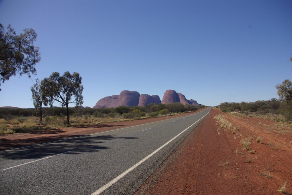
Leaving Yulara the following day we headed west towards the WA border, stopping at Kata Tjuta (the Olgas) for a short 2.6km walk. Fortunately it was only short, as the wind was so cold and strong coming through the gorge that we could hardly walk. Another stunning location, and other walks might have been worthwhile, but for the wind.
Leaving Kata Tjuta we continued west to follow the Great Central Road into WA.
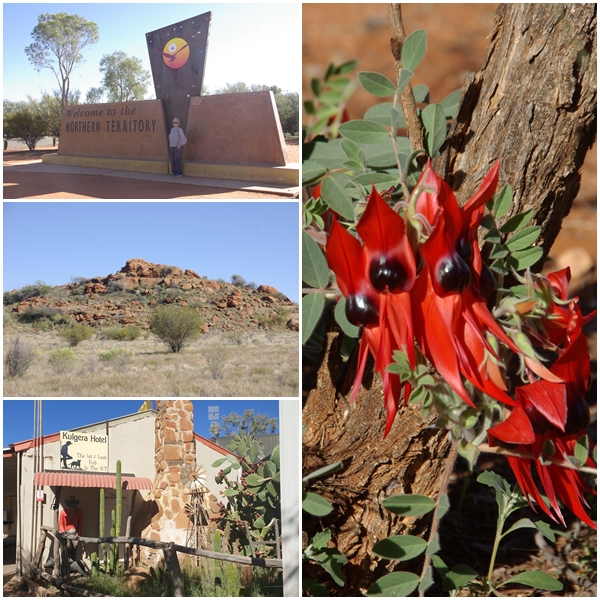
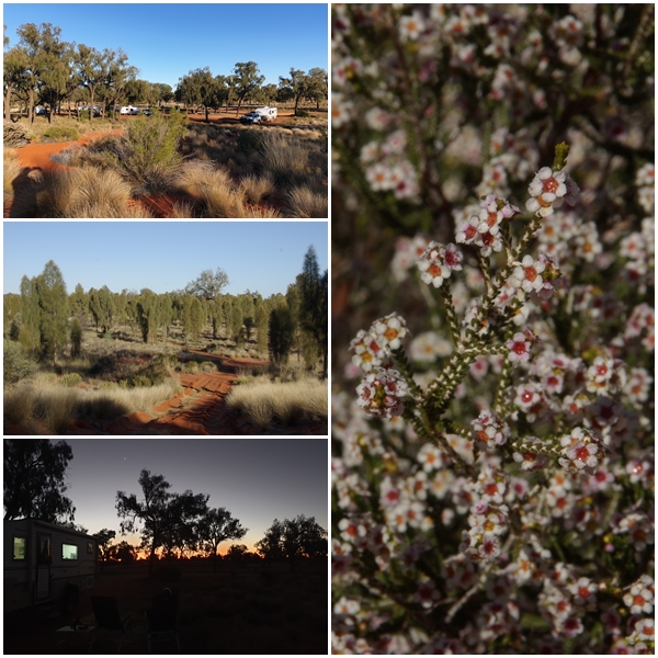
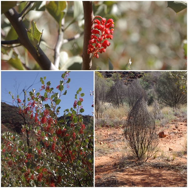
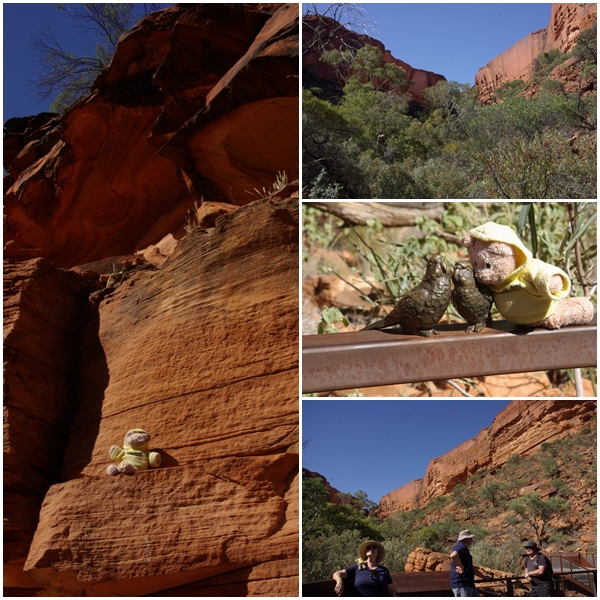
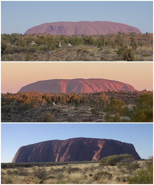
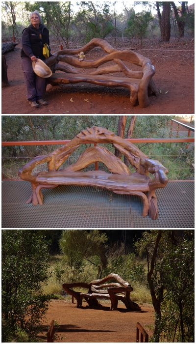
Agnes Ck rest area, 73km south of the SA/NT border. Three days of clear skies, but windy through the day. Winds dropped in the evening allowing a fire, and a camp oven lamb roast, and star gazing.Upon crossing the border into NT the landscape changes dramatically. 19km north of the border we stopped at the Kulgera Roadhouse for morning tea and internet access to finalise and publish an earlier blog post and do some club emailing. The Sturt Desert Pea was located at the border.Salt Creek rest area, 165 km short of the Watarrka National Park (Kings Canyon). A multitude of red sand dunes in the Liddle Hills with some lovely vegetation and of course stunning sunsets.Middle Range approaching Watarrka, which forms part of the Kings Canyon landscape.Holly Grevillea (Grevillea wickhamii) near Kings Canyon, plus a rather strange plant that looks like a bower bird nest.Two popular walks at Kings Canyon are the rim walk and Kings Ck walk. We tackled the easier creek walk on our first day there, passing through shaded creek crossings and under stunning eucalypts, before getting sight of the sheer canyon walls above.Yum Yum found the creek walk suited his fitness level, and he particularly enjoyed meeting two budgerigars, however they were rather stiff. The walk ended at a viewing platform under the cliffs.After the creek walk, we retired to the van for a while then proceeded to the Light-Towers Lookout Bar to take in some energy drinks in preparation for tomorrow’s Rim walk. At the bar we met a couple who we’d camped near at Salt Creek. A great couple, Helen and Mark from west of Newcastle NSW. The steel structure is the information area at the start of the walks.Photos just can’t do the rim walk justice, especially when the primary camera has a flat battery, so I had to resort to the phone camera.Not only are there sheer cliffs, but also weathered beehive-like domes around the top of the canyon. This Mereenie Sandstone was originally sand dunes 400 million years ago.The start of the Rim Walk was a steep 100m climb via 500 steps up a rough craggy slope. After the initial climb it levelled out and was an easy walk, with steep sections traversed via manmade stairs and bridges. Unfortunately we arrived at the start of the walk at the same time as a bus load of tourists, plus a smaller group who had a professional photographer in tow to take constant photos of the group, and especially a few girls in their 20s or so, undoubtedly for their social media pages. We tried losing the groups several times, eventually letting them get well ahead.Often mistaken for Uluru is Mount Conner, which is the first “mountain” seen as you approach the Uluru – Kata Tjuta National Park. A lookout provided a good view of Mt Conner, and in the other direction, a salt lake, one of many stretching across the landscape.Three moods of Uluru.Along the 10.6km base walk of Uluru were several seats, beautifully constructed from tree limbs.
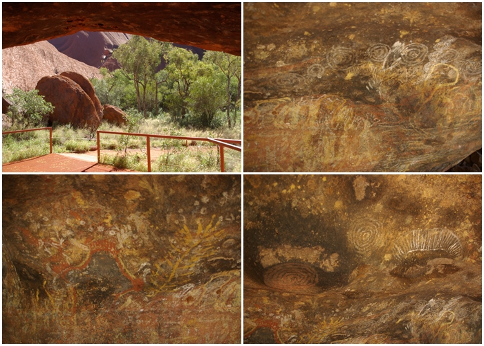
At some locations around the rock were waterholes, this one being the most significant. It would have been welcome relief on hot summer days. We named the three rocks the “3 Sisters”. The little bird enjoying being close to water is a White-plumed Honeyeater.Art at the RockApproaching Kata-Tjuta and the cold and windy Walpa GorgeFarewell Uluru-Kata Tjuta NP. A parting photo of Kata-Tjuta (The Olgas)
2 thoughts on “The Red Centre”
More great photos – made more interesting seeing we were there last year. I’m so glad I took the right turn at Walparra, those cliffs look way to scary from the top. The Gorge is beautiful as it is. Also did Helen Gorge further east which was lovely and no one else around. We also had cold and windy conditions at Kata Juta walk.

More great photos – made more interesting seeing we were there last year. I’m so glad I took the right turn at Walparra, those cliffs look way to scary from the top. The Gorge is beautiful as it is. Also did Helen Gorge further east which was lovely and no one else around. We also had cold and windy conditions at Kata Juta walk.
Kata Tjuṯa ( forgot the T).