26 July 2023 to 30 July 2023
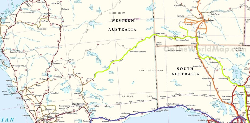
Part of the 2,800km Outback Way (“Australia’s longest shortcut”) that links Winton in central Queensland to Laverton in WA is the Great Central Road (GCR), the westernmost 1,100km of the shortcut, primarily unsealed, linking Yulara in the NT to Laverton.
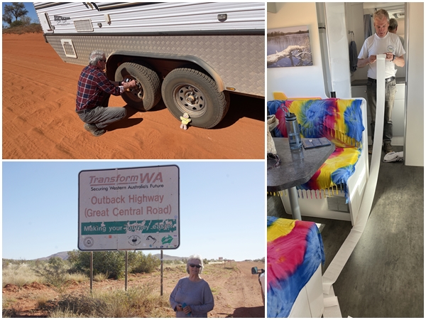
The GCR passes through Aboriginal land, requiring us to obtain travel permits, one for the NT and one for WA. The WA permit restricted us to 3 days to travel the WA section of the road, which was doable, although it is not policed.
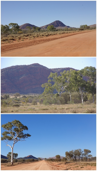
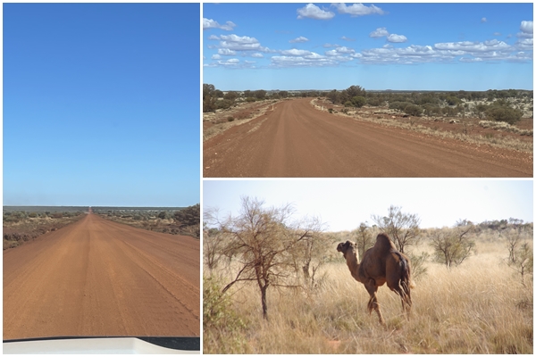
Upon leaving the western boundary of the Uluru-Kata Tjuta NP, we were surprised to find the GCR was sealed for some distance before we reached roadworks where significant improvements are being made to the road, building it up to make it more flood-proof. We had to detour onto a side track for 30km which was in reasonable condition, signposted at 60kph. Upon reaching the unsealed road we dropped our tyre pressures all round to soften the corrugations.
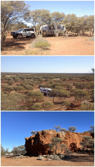
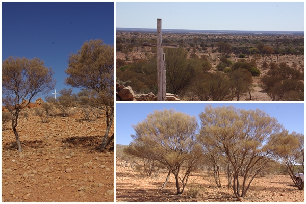
We had planned to overnight at the Docker River campground near the Kaltukatjara community just before the NT/WA border. Upon arrival we were the only ones there, making us feel a little vulnerable and as we had arrived early, there was still plenty of time to continue further west. So we blazed on further into the Gibson Desert. And what a treat that was. The landscape continually changed, from low mountain ranges to broad plains. Coming over crests we were often greeted with wide vistas of the mulga covered desert below us. I used our dashcam to save some of those images but unfortunately the save button isn’t working so they were lost as the video files are overwritten every for hours.
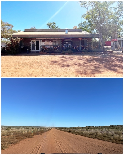
We arrived at the Warakurna Roadhouse just in time (not a minute to spare) to fuel up before they closed the roadhouse at 5:00pm central time. We had assumed they’d be working to western time. We then went around the back to camp for the night.
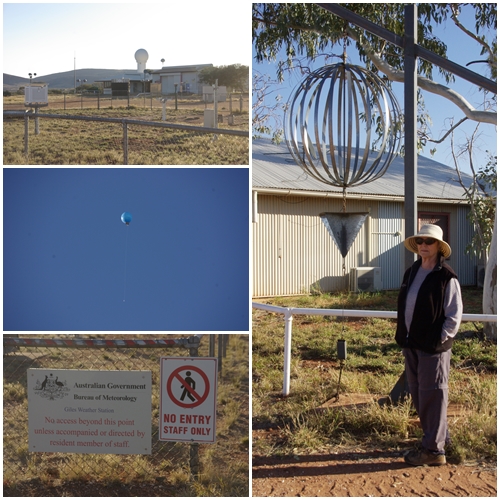
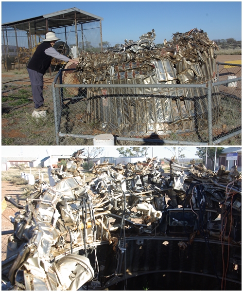
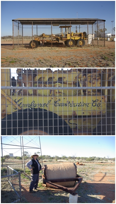
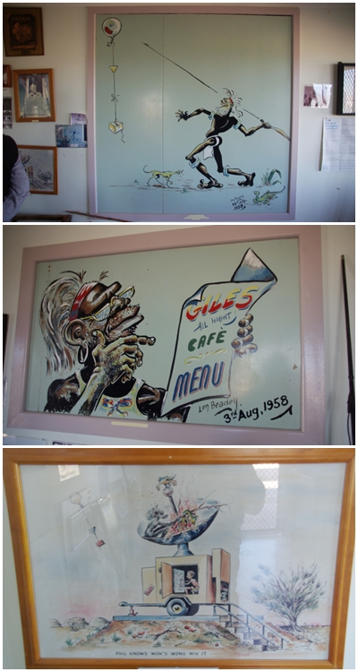
The roadhouse is near the Giles Meteorological Station, which enabled us to witness the daily morning release of the weather balloon at 8:45am and be informed about the weather station by one of the weather observers. Totally fascinating, and she seemed to enjoy the chat, answering my barrage of questions. The weather station is no longer open to the public, but a small museum is at the rear, together with memorabilia of Len Beadell, a famous road builder in the area from the 50s and 60s.
We travelled 363km to our next camp with the odd name of Desert Surf Central. We stopped for fuel at Warburton, costing us $3.10 per litre, the dearest so far. Fortunately we only needed 54L. We go by the rule to never drive past an open roadhouse when in the outback without topping up the fuel. You never know if the next roadhouse will be closed.
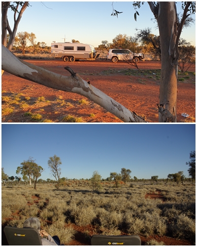
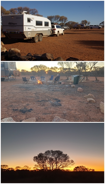
Two other co-travelling vans pulled in to the camp, one being a Bushtracker. It always feels safer when other campers are around. We joined them around their campfire as the sun set.
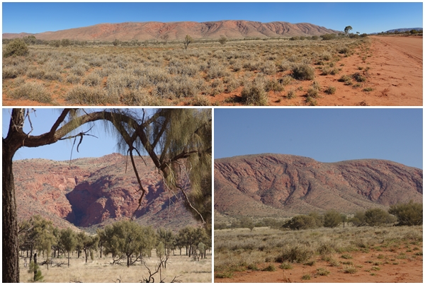
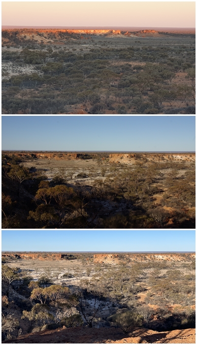
On the following day 375km had us arrive at our next campsite, Giles Breakaway. An amazing location with wonderful views from the escarpment to the Great Victoria Desert. The two other vans from the previous night had arrived before us, so we camped near and again shared a campfire into the evening. It was a Friday, so we retired to the van to make our pizza.
We stayed a second day at the Breakaway as we had internet access and a great campsite. Another Bushtracker pulled in to air up his tyres, and we encouraged him to stay for the day as the other two departed, leaving a terrific site for him with great views. Giles Breakaway heralded the end of the unsealed section of the GCR, leaving only 51km to reach the end at Laverton.
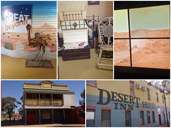
Laverton is a very small but tidy town. Arriving on a Sunday just about everything was closed, except the Great Beyond Explorers Hall of Fame and the fuel outlet. The Hall of Fame was exceptional, spending a few hours reading about the early explorers of the region, such as Ernest Giles, Edward John Eyre, Major Peter Warburton, Tommy Windich, Lord John Forrest, David Carnegie, John Roe, Frank Banks, Dr Charles Laver (after whom the town was named), Ellis Rowan, Daisy Bates and even R.M. Williams.
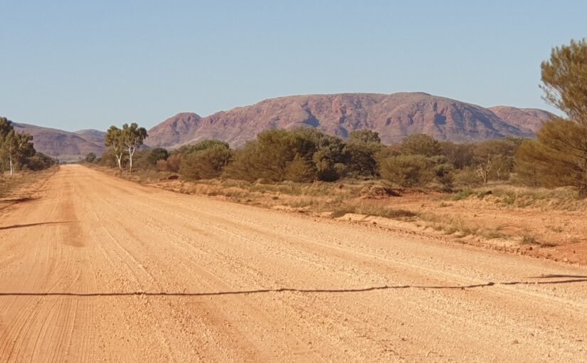
Overall, how was the road? Really quite good, able to maintain an easy 80kph for most of it. The road was so wide there was nearly always a section across its width that didn’t contain corrugations, or at least smaller ones. In fact, we probably covered about 20% of the total length of the GCR on the wrong side of the road, only moving back to the left approaching crests and bends, of which there weren’t many. Nor were there many other vehicles.
Good to see you made it across the desert.
I read a book by Leonard Beadell many years ago, (don’t know where the book is now) about his travels and how he went about making the roads. Basically he would go into the desert for months at a time with a compass and directions and create a road with his grader. He had lots of interesting things happen.
Happy travels
Hi there, got in. Thanks, Graham for instructions. Great to read about your adventures and the photos are amazing.
Have a safe and wonderful time.
Whao, love this trip. Would be interested in this route, except for towing your house with you!
Hi Graham and Carol, I’ve been following your Blog but only just worked out how to leave a comment. Love the commentary and the photos. Looks a great ride.