Indian Interlude

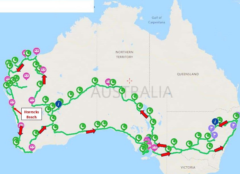
Friday 18 August to Monday 4 September 2023

We left Karratha mid-morning, and after a few chores in town headed south. With just over 2 weeks before we have to be at the Bushtracker Muster site at Horrocks Beach, 1,100 km south, we chose to do an Indian Ocean hop, making our way down and staying at what we hoped would be lovely beach-side camps for several days at a time.

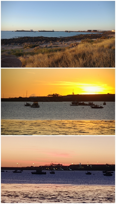
First stop, 40-mile Beach (Gnoorea Point), a short 60km from Karratha. A freedom camp, something between a free camp and a caravan park. Fees apply, but the sites are large. We scored a lovely beach-front site, much to Carol’s delight, just what she’s been looking forward to for weeks. Unfortunately it’s not a particularly good location to swim as the foreshore is made up of limestone, but great to relax for 2 days.

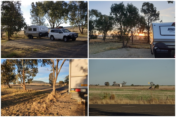
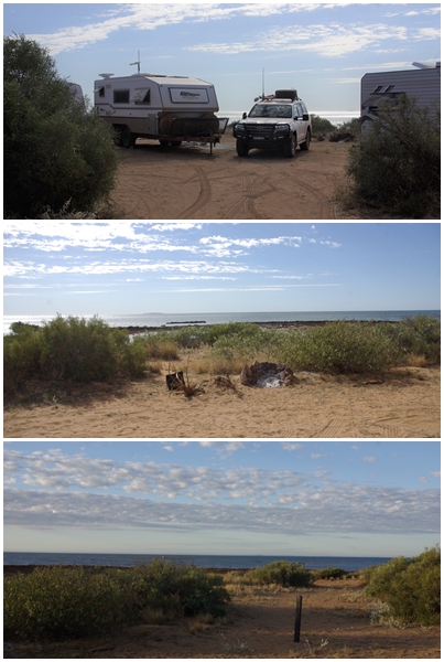
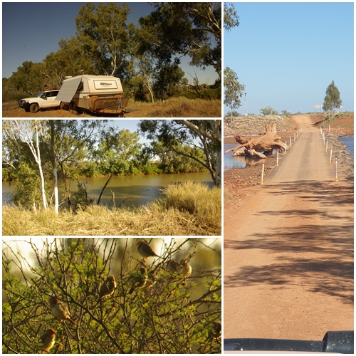
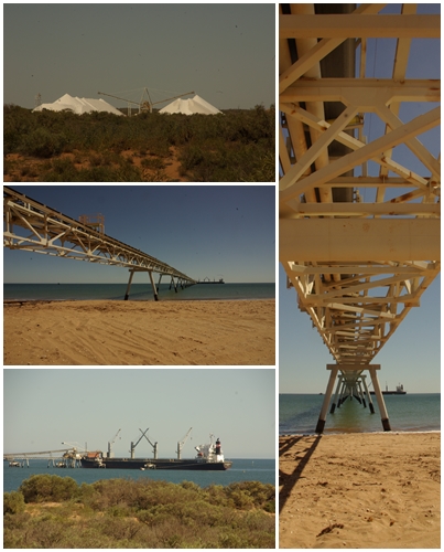
On Sunday we moved again, travelling 264 km to a free camp beside the Ashburton River near Onslow. First in – best dressed, so we found a suitable site, dropped the van, then continued along the river in case a better site was available. We found two other BOGGERs camped together just a few hundred metres from us. We stayed at our site but joined Gary, Lyn, Brad and Denise for drinks that evening.

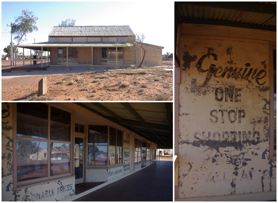
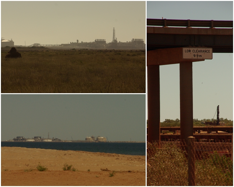
Next day into Onslow for a sticky beak, then back to camp. Found another Bushie had pulled in, but was unattended so I left a note inviting them to our van for drinks. Chris and Sally did join us, as did Brad and Denise, plus 2 of their friends, Graham and Jan. As it turned out, Brad, Denise, Graham and Jan all knew Sally’s father……small world.

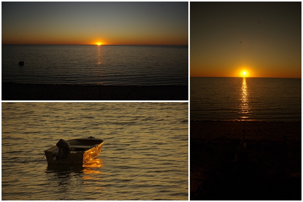
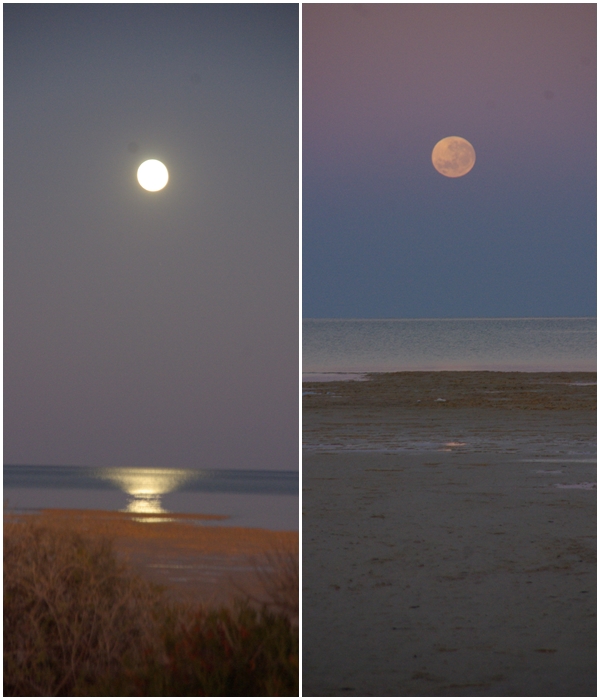
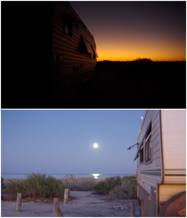
Despite being beside the river, we couldn’t swim due to the presence of crocodiles, not that we saw any. After three nights at the Ashburton River we continued south toward Exmouth, stopping at a free camp where we joined Brad and Denise again for an overnighter.

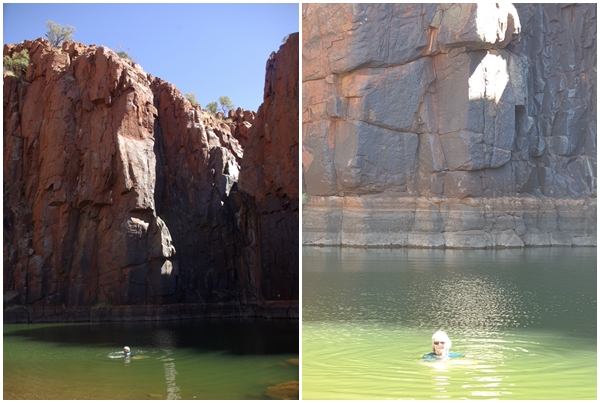
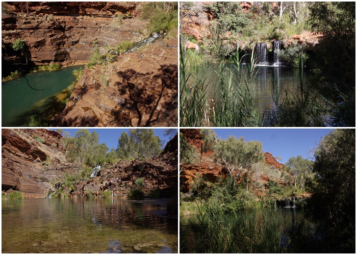
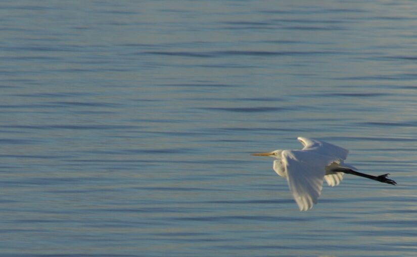
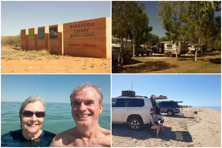
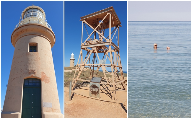
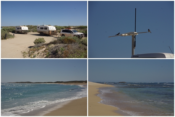
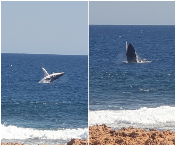
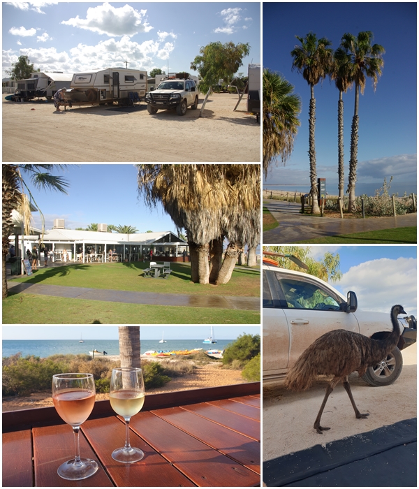
Two nights on power and water at Exmouth caravan park with a large site and nice neighbours make it tolerable. After setting up we got our washing done and drove around town. A spot of shopping including snorkels and goggles, then a late afternoon swim at Town Beach.  Our first swim in the Indian Ocean. The following day we headed around to Cape Range National Park and the Ningaloo Reef. Such an awesome experience. After hiring fins from the Milyering Discovery Centre and seeking advice on snorkelling locations, we headed off to the nearby Lakeside snorkel area. Dare I say it was better than the Great Barrier Reef snorkel we did several years ago. An abundance of beautiful fish of all shapes, sizes and colours sneaking in and out of the coral all within walking distance from the shore.

Back to the van to collect wine and nibbles, then off again to Town Beach for another swim.

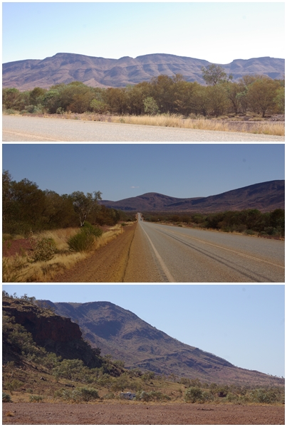
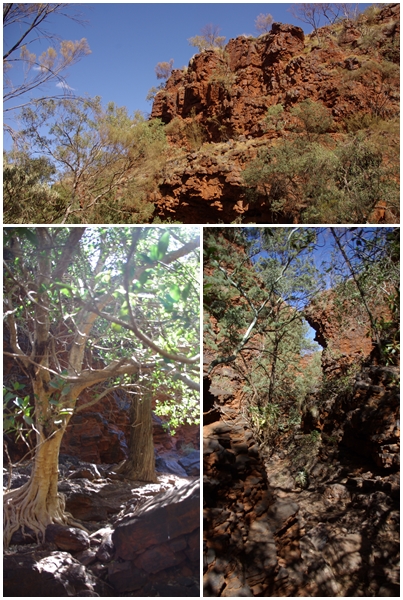
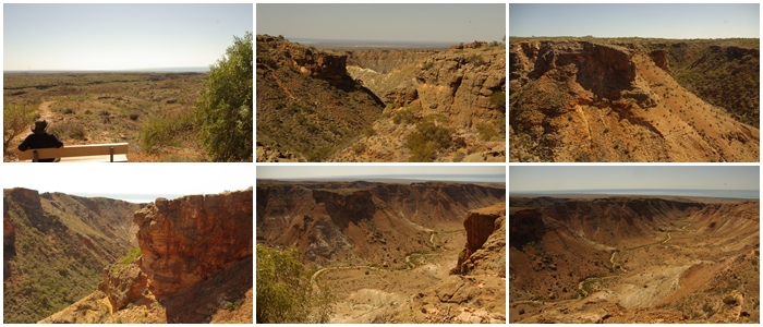
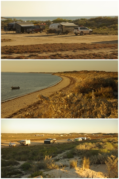
Saturday, we headed off to Bruboodjoo Point, after a detour up the eastern side of the Cape Range, leaving Blake at the bottom of the first incline.

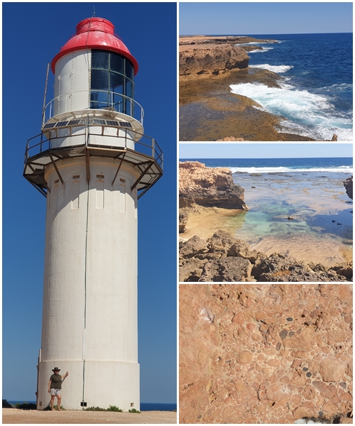
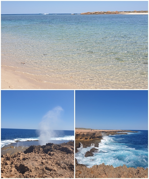
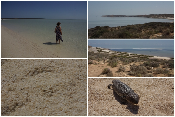
We stayed two nights at Bruboodjoo, tucked in behind a coastal dune. Not an inspiring campground, though it was huge. The water was a little murky from recent strong winds. From there it was to Quobba blowholes campground, stretched out along the coast for a few km. We found a spot next to BOGGERS Helen and Wayne. At one end of the campground was the “aquarium” a sheltered coral reef great for snorkelling at high tide. Again, lots of fish and coral plus limestone A lovely region of the coast.

Following Quobba, it was two nights at Gladstone Bay campground, a sprawling freedom camp along the Indian Ocean shoreline. It wasn’t too crowded so we were able to snag a good site on the waterfront. Unfortunately, the Bay is very shallow, so a long wade out to a limestone reef was required for snorkelling. Nothing to see that day. Whilst there we met two more BOGGERs, Chris and Nicola, who were also heading to the Muster.

From Gladstone Bay we continued south to the bottom of Shark Bay, then up the peninsula to the Monkey Mia resort for two days, where we met more BOGGERs on their way to the Muster, Matt and Renee, and Frank and Maree, all first timers to an AGM Muster. The “famous” Dolphin Experience at Monkey Mia was a bit of a letdown, as we expected from various recent news items. They only feed two named dolphins who didn’t show up that morning. A few other dolphins swam in to the shore, but weren’t fed. Close to 200 tourists to view six dolphins.

A further 300kms south for an overnight stop where we met BOGGERs Paul and Jillian, then we were off early to fill with water, fuel, food and wine at Northampton before the final 24km to the Muster site at Horrocks Beach.

40 Mile campground at Gnoorea Point. We had a lovely site with views of the Indian Ocean from the balcony, but we didn’t swim due to the shore being lined with limestone rocks.
Sunsets over the ocean are spectacular.
South of 40 Mile is the coastal town of Onslow, near which flows the Ashburton River. Lots of sites are scattered along the river at this free camp. We had a sunny site next to the river. It was a steep bank down to the water, however swimming was off the agenda due to the possibility of crocodiles. Downstream of our site is a causeway which trapped a huge tree during a storm in the past. Lovely Star Finches, with the red faces and spotty chests frequented our site.
During WWII Onslow became the southernmost town in Australia to be bombed. Its airstrip, radar station and fuel tanks had made it a target. The installation on the foreshore commemorates those who served.
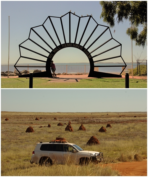
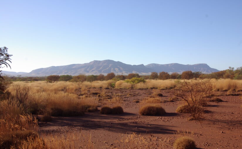
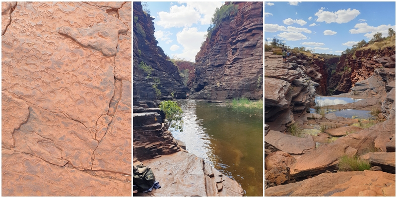
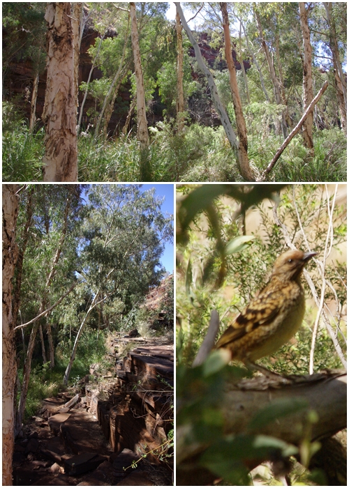
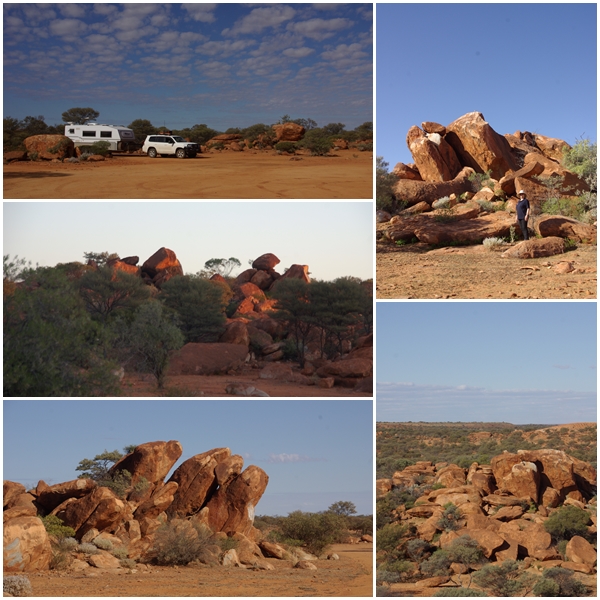
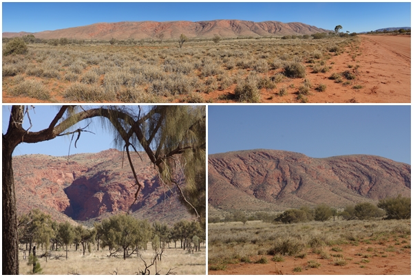
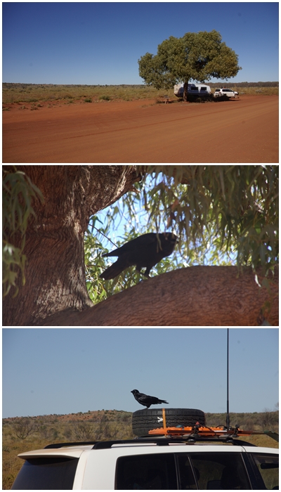
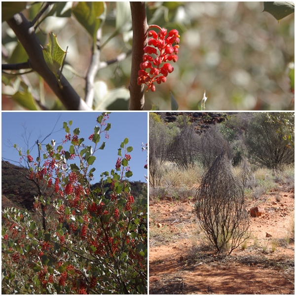
The region is littered with these termite mounds. Considering there are no trees to be found, Carol and I were surprised at the number of mounds. These are spinifex termites, so they have a abundant supply of food.
Onslow’s hot, dry climate makes it an ideal location for salt production. Commencing in 2001, the Onslow salt covers 90km2. Seawater is captured in ponds which are then drained and the salt is harvested, stockpiled and then shipped from Sunset Point to the Asia-Pacific region.
The original town of Onslow was located on the Ashburton River, 20km west of today’s Onslow. Established in 1883 it served as an important hub for the surrounding sheep and cattle stations. From the early 1890s, the shift in the river’s course and rapid silting threatened trade. A cyclone in 1899 destroyed the sea jetty, and the town and jetty were relocated in the early 1900s.
Old Onslow’s police station comprised of an office, courthouse, lockup and living quarters. Constable William Maxwell served as the first police officer in 1893. Extended in 1906, the lockup served as a gaol for mostly aboriginal prisoners (Masters and Servants Act). The iron ring in the floor was used to shackle aboriginal inmates throughout the day.

Oil and gas production plus mining are significant industries in the region. If 9.9m is a low clearance, I wonder what they consider a high clearance!!!
Covering 604,500ha, the Ningaloo Coast World Heritage Area includes the Cape Range National Park, Ningaloo Marine Park and a variety of diverse sites, stretching over 160km south from Exmouth. Camping at Exmouth caravan park enabled us to enjoy our first swim in the Indian Ocean at the nearby Town Beach.
Vlamingh Head lighthouse and radar tower, a relic of WWII used to provide early warning of Japanese air attacks on the Allied bases in the area. Carol relaxing at Town Beach.
The eroded hills of the Cape Range National Park in the Shothole Canyon make for an interesting landscape, another one that needs dinosaurs to complete the picture.
9 mile camp at Bruboodjoo Point is a large freedom camp (fees apply) with many choices of sites. Tucked behind the sand dune we were protected from winds, but missed the view. The beach was quite nice, but the water dirty from strong winds over the previous week, and it was too cool to swim anyway.
On our first night at Bruboodjoo Point we took our chairs and wine to the top of the sand dune to watch the sun sink into the Indian Ocean.
275km south of Bruboodjoo Point we stopped 2 nights at Pt Quobba Blowholes campground, camped next to BOGGERs Helen and Wayne. A pair of Welcome swallows used our aerial from which to look for suitable nesting sites.
Point Quobba lighthouse and surrounds.
Near the blowholes is a protected snorkelling area called “the aquarium”. It can only be used at high tide, but it provided an easily accessible area to view fish amongst the limestone reefs.
A young humpback whale frolicking just off the rocks at the blowholes.
Our camp at Gladstone Bay
Two activities available at Gladstone Bay; Sitting on the dock of the bay if you’re a cormorant, or trying your hand at mini golf.
Moon setting at Gladstone Bay one morning.
Simultaneous sunrise and moon set from opposite ends of the van.
Peron Homestead
Monkey Mia Resort, Shark Bay.
Shell Beach on the southern end of Shark Bay, with a shingleback (stumpy tailed) lizard out for a morning warm-up walk.
Galena Bridge, Ajana, our final camp before reaching Horrocks Beach for the Bushtracker AGM Muster, with BOGGERs Jillian and Paul.

More Ore

Tuesday 16th August 2023 to Wednesday 17th August 2023

After two days in Dales Campground in Karijini National Park we were happy to leave and forfeit  the last two days of our booking in order to get away from the dust and head to the coast and see more of WA.

First stop Tom Price. Shopping, more fuel, washing, then overnight at the caravan park. Friends had advised us of the most direct route to Karratha was via Rio Tinto’s rail access road that follows their rail line from Tom Price to their loading facility in the port of Dampier. A private road that can only be used with a permit. After watching a 20 minute safety video we were good to go.

The rail access road was unsealed, but in good condition. The speed limit was 80 kph, and with tyres down a little, we had a good ride, with great views of numerous ore trains, full heading north and empty heading south.

After leaving the access road we found a turnoff to Python Pool. It looked great in the travel brochure, so we headed there. Spectacular scenery along the way, but a horrendous road. The worst one so far this trip. The pool, whilst nice, really wasn’t worth the jarring drive. Despite having lowered the tyres to use the rail access road, we had to drop them more to travel on the road to the pool. The side trip and fiddling with the tyres got us into Karratha just 15 minutes before the van park office closed. A quick set-up and we were off again to Dampier, 18 km away, with wine and nibbles to enjoy the sunset before heading back to camp for just one night in Karratha.

Rio Tinto operates the largest privately owned heavy-haul rail network in Australia, connecting17 iron ore mines in the Pilbara to ports in Dampier and Cape Lambert.
Python Pool is located in the Millstream Chichester National Park. The scenery through the national park is other-worldly, and conjures up images of dinosaurs roaming the valleys.
Python Pool. Fortunately no pythons made their presence known.
Dampier’s Parker Point ore loading terminal and sunset from the foreshore park overlooking the East Intercourse Island loading facility. An odd name for an island!!

Karijini

Friday 11 August 2023 to Wednesday 16 August 2023

Leaving Mt Robinson we continued north along the Great Northern Highway deeper into the dry, sparsely populated Pilbara Region and into the Hamersley Range. The range was named on 12 June 1861 by explorer Francis Thomas Gregory after Edward Hamersley, a prominent promoter of Gregory’s exploration expedition to the northwest. Karijini National Park (formerly known as Hamersley Range National Park) lies within the range.

Karijini is WA’s second largest national park, covering 627,000 hectares. Much of the southern half is inaccessible, with visitors concentrating on the spectacular gorges to the north.

We arrived at the Karijini NP three days prior to our campsite booking at the Dales Campground within the Park. A visit to the Information Centre revealed that the park was full, as we expected, and couldn’t move our booking forward. The staff at the Information Centre suggested a free camp near Mt Bruce just outside the western boundary of the park. As it was relatively close to Hamersley Gorge and several western gorges within the Park, we headed out there, being able to visit those gorges from Mt Bruce before moving to Dales Campground to explore the gorges in that location.

The campground at Mt Bruce was huge, enabling campers a lot of separation. We stayed at the van on our first day, meeting another couple from the BOG, Warren and Gail, for evening drinks. We set off early the next day to explore Weano Gorge and Joffre Gorge, taking some of the shorter walks to waterholes and lookouts.

On the Sunday we ventured up to Hamersley Gorge, 55km to the north. I explored some of the pools and took a long swim in the main waterhole. By the time I got back I was cold to the bone. It took over 30 minutes to stop shivering. We bumped into Wayne and Helen from the BOG, and as we were both heading into Tom Price for supplies, we had lunch together there. After Tom Price we returned to Mt Bruce.

On Monday we packed up and moved onto our booked site at Dales Campground. We had booked 4 nights, but as we’d already spent 2 days exploring the west end of the park, we only needed 2 days to do the east, so we left early. On the Monday we did the Dales Gorge rim walk and at night we enjoyed an entertaining three hours stargazing with Remtrek Astronomy, hosted by Phill, who’s been doing these sessions in Karijini NP for 27 years.

On the following day we enjoyed Fortesque Falls and Fern Pool, and I did a short walk into Dales Gorge. It was all very relaxing and satisfying. Karijini is a wonderful park, well worth the visit.


The first gorge we visited was Weano Gorge, heading into the lower gorge toward Handrail Pool. It’s a tough life for some in these steep rocky gorges.
The gorge shows signs of tens of thousands of years of flooding torrents of water that have polished the rocks to a smooth finish. No, Carol didn’t slip on the rocks, she just thought she’d try an influencer pose. The gorge narrowed down for part of its length.
At one point a small waterhole had developed, requiring us to negotiate around it on the terraced rocks surrounding the pool and through a narrow section.
Upon reaching Handrail Pool the name became evident. It’s amazing how over millions of years the iron laden rock had formed a steel handrail to the lower pool. The water was absolutely freezing. I couldn’t swim more than one third of the way across the pool before having to return, despite there being access to another pool through a narrow gap across the pool. Carol wisely chose not to negotiate the ladder to the pool.
After emerging from the lower gorge we stopped for a swim in a sun drenched pool, which was just warm enough for Carol to enjoy.
After the warmer swim we followed the track along the floor of the upper gorge, which then took us up to the rim edge for spectacular views back into the gorge.
The next gorge we visited was Joffre Gorge. Numerous steel ladders allowed a descent into the gorge. Carol chose to opt out this time. I ventured downstream to a larger, lower pool which was another great, though cold, swimming spot.
At the upstream end of Joffre Gorge is a spectacular amphitheatre and waterfall. Unfortunately no water was falling.
Our camp at the Mt Bruce campground outside the western end of the park. Balcony views of the sunsets were amazing.
The Hamersley Range, on our way to the Hamersley Gorge.
Hamersley Gorge’s banded iron formations that originated more than 2,500 million years ago, which were subsequently compressed and buckled over time.
Water flows though numerous pools in the gorge. I didn’t venture too far upstream, but the long downstream pool, just visible in the middle photo, was too much of a temptation to not swim the 200m to the end of the pool. Mild hypothermia was the result upon the return 200m. The bottom photo shows how deep the gorge is, from the lookout to the pools below.
Dales Campground within the Karijini National Park. Heaps of space between sites made for a pleasant stay.
Dales Gorge rim walk.
Fortescue Falls (left) and Fern Pool (right) in Dales Gorge. The latter was particularly beautiful with cool, clear, deep water, and fish that nibble your skin.


The floor of Dales Gorge, and a local inhabitant (that I couldn’t identify).

Oresome

Monday 7 August 2023 to Friday 11 August 2023

Having driven into Meekatharra from Peace Gorge on Monday morning to enquire as to the possibility of a wheel alignment, we had no joy on that front, even from the tyre retailer, however, another service station manager in Meekatharra suggested two locations in Newman.

Back to the camp to hitch up and we were on our way northbound. Stopped for fuel at the Kumarina Roadhouse and bumped into Russell and Denice from the BOG. They were heading south before going to the Muster. Our journey took us past numerous ranges, such as the Robinson, Collier and Lofty Ranges and passed the Little Sandy Desert, crossed the Tropic of Capricorn and into the Pilbara region before reaching Newman.

There was no room at the Inn that night (Newman Tourist Park), however we booked the next three, and headed to a free camp just out of town for the night. Returning the following morning we left the van at our van park site and took Henri to a pre-booked mechanic to get the equivalent of a NSW pink slip. These aren’t required in WA, SA, Tas or Qld. Normally costing $36 in NSW, WA had to do a full mechanical inspection costing $211. No wonder WA is a wealthy state.

After the all-day inspection we checked on the three tyre places in Newman. Two didn’t do wheel alignments and the third was closed for stocktake. I rang first thing next morning and managed to book in for two days later.

In the meantime we did a tour of BHP Billiton’s Mt Whaleback Iron Ore Mine. A fascinating excursion we’d recommend to anyone. On our final night, BOGGERS Tassie Pete and Jenni arrived, enabling us to catch up over a drink in the late afternoon. Tour over, Henri registered and wheels pointing correctly, oh and a windscreen chip repaired, we headed out of Newman the following day further into the oresome (awesome) Pilbara. An amazing landscape of deep red and near black soils and rocks dotted with spinifex.

A short drive of just 88km took us to a free camp at Wanna Munna Gorge. It had 5 stars on Wikicamps so must be good. The 2km drive off the main road was a goat track that left Carol unnerved, so she walked the last 500m. It was a beautiful peaceful location, and a registered Aboriginal art location, though there wasn’t a great deal to see in the Gorge. Carol found the return trip along the goat track next morning more palatable as she knew what to expect. Henri and Blake enjoyed that part immensely.

Top: possibly the Glengarry range just north of Meekatharra
Bottom: possibly the Lofty Range 100km south of Newman.
Some old, obsolete mining machinery (not me) at the Newman Visitor Centre; and the Newman township from Radio Hill. The truck is a 200t Wabco ore truck, one of 22 owned by Whaleback Mine. This truck was worth $2.5m in 1973, when it was donated to the Visitor Centre for $1.00. The other is a P&H face shovel from the mid 1960s.
The main pit at Mt Whaleback, 500m deep, excavating Brockman Hematite which is 68.8% iron, blue grey in colour, and is one of the highest grades in the world.
The 3 x 110t drill rigs are working on a drill pattern. All holes will be 12 – 16m deep and blasted with 300-600kg of ANFO explosive; The blasted material is being loaded by a massive LIEBHERR R 996 excavator into 240t Caterpillar dump trucks (each worth $6m), which then have to make the gruelling climb to the primary crusher.

Ore being tipped into the primary crusher; One of five, 110,000L water carts keeping the dust at bay; Ore being blended to meet client specifications.

The lower grade Mt Whalebone pit which provides Goethite Limonite, which is 61% iron ore and is ocre in colour; A small ore train arriving from a satellite mine. (the long thin ribbon in the middle of the centre photo) This train has only one locomotive and 70 ore cars, whereas the trains that transport the crushed and blended ore to port consist of 4 locomotives and 268 ore cars, averaging 2.9km in length with a payload of 42,000t of ore; The reclaimer used to load the ore trains for their 426km journey to Port Headland.
Our camp at Wanna Munna Gorge, and the view from the balcony.
Some of the art in the gorge.
Downstream of the gorge. Two other vehicles arrived after us and asked if I’d been for a swim. I had to disappoint them, as there was no water in the gorge. It’s been too long since the last rain.
The Hancock Range; and Mt Robinson north of Newman.
Mt Robinson Gorge.

Gold to Ghosts

30 July 2023 to 6 August 2023

Continuing west from Laverton along the Outback Way we were travelling through WA’s Goldfields region which covers Coolgardie and Kalgoorlie in the south to Agnew and Leinster in the west and north. We didn’t travel south to Kalgoorlie this time, but will be there in a few months.

The first town west of Laverton is Leonora, a main regional centre in the northern goldfields, established in 1896, one year after gold was discovered in the area. Three km south of Leonora is the ghost town of Gwalia, established in 1896 with the establishment of the Sons of Gwalia Mine. The mine eventually closed on 27 December 1963. Within a matter of days 1100 of the 1140 inhabitants left town, most with only what they could carry. Gwalia then became a ghost town.

After 2 nights in Gwalia with the ghosts, we headed south to Lake Ballard to view the Antony Gormley Structures. On the way we dropped into another mining ghost town Kookynie, with its Grand Hotel, and the nearby Niagara Dam, then on to Menzies, a small town despite being the administration centre for the region. From there we headed to Lake Ballard with the intention of camping lakeside (salt lake) for two nights, but after viewing just a few of the sculptures we decided, rightly or wrongly, that one night was sufficient.

We could have doubled back on sealed roads through Menzies and Leonora to reach our next destination, Mount Magnet, but why not take a perfectly dusty shorter route. I try to avoid retracing our steps, as there’s always something to see elsewhere. We took the direct road to Sandstone, an ex-mining town near Mount Magnet. The wind was starting to pick up, and as always it was a head wind, and by the time we reached Sandstone it was blowing a gale. We decided to bunk down at the caravan park for the night. We’re so glad we did, as it is a lovely little town with history and heaps of pride to match.

Heading west from Sandstone takes us out of WAs northern Goldfields region into Gascoyne Murchison, but it is also full of new and extinct mining towns.

Though only 152km from Sandstone to Mount Magnet we ended up staying the night at Mount Magnet, again in a caravan park. Not our preferred form of camp site. The lady in the Mt Magnet Information Centre suggested a long, unsealed route to our next stop, Cue, rather than the direct 80km, in order to see a meteorite crater, a big rock and another ghost town, so a fresh morning start on the detour was decided upon. The meteorite crater was a serious let down, being the smallest in Australia, but Walga Rock didn’t disappoint and the ghost town of Big Bell was interesting, and a great location to spend the night with the ghosts.

Bidding the ghosts farewell the next morning we headed into the historic town of Cue, for a walk around in the morning then continued north to Meekatharra and a few nights at a free camp at Peace Gorge. Henrietta needed a wheel alignment, so I enquired whilst at Cue and no one did them there, so next was Meekatharra. We were hopeful, as there was a tyre retailer in town, but it was closed, being a Saturday. Hence 2 nights at Peace Gorge until Monday to enquire, but to no avail. We’d have to continue north to Newman, a further 420km, with hope of getting it done there.

Built around 1920, Patroni’s Guest Home was one of a number of boarding houses in Gwalia for single men working at the Sons of Gwalia Mine. The 16 rooms could each accommodate 2 men. The guest house closed not long after the mine closed in 1963.
Originally built in Laverton, this general store was moved to Gwalia in the early 1900s, then purchased by Victor Mazza and relocated within Gwalia in 1955. Mazza’s store supplied all household basics plus a range of imported items sought by the migrant community.
Gwalia is dotted with ramshackle miner’s camps, boarding houses and various other structures, pulled together by their owners using whatever materials could be found. The building centre left was built c1920 by Italian Glovan Andreoletti. Originally located south of the State Hotel (top left) the camp consists of a bedroom and a kitchen with a small stove alcove. The interior walls are lined with hession. Gloven was interned in 1942 until 1944. The Lock-up (right) was originally from Murrin Murrin and is typical of the lock-ups from the early 1900s. Unlike many of the houses, the lock-up has jarrah boards lining the interior.
All the mod-cons were available within the houses.
Wall linings included hessian, canite, pressed metal, corrugated iron and the newspapers of the day.
Before reaching Leonora and Gwalia we dropped into another ghost town at the Mt Morgans mine and Murrin Murrin. Gold was discovered at Mt Morgans in 1896 and in 1899 the town site was gazetted. At its peak in 1903 the population was 1,300. The easily won gold soon ran out and the mine closed. Reworked in the 1980s and 90s the mine remains closed. The nearby Murrin Murrin mine produces nickel, cobalt and ammonium sulphate from nickel laterite ore.
There is a free camp adjacent to the Gwalia Museum. Not flash, but the price is right.
With improved exploration and mining techniques the Sons of Gwalia Mine commenced open pit mining in 1983. Underground mining recommenced in 2005. Now the deepest trucking mine in the world at 1,600m below the surface it takes approximately 80 minutes for a truck to travel the 11.5km to the surface on a 1 in 7 gradient. There is a truck climbing the incline in the top photo. The white structure in the bottom photo is part of the ventilation system for the underground operations.
The headframe and winder built in 1899 transferred men, horses, ore and mining equipment between the surface and underground levels. Everything was transferred in small skips. Horses were used underground until the 1950s. Originally located where the open cut operation is now in progress, the headframe was relocated to the museum site in 1987. It is the only large timber headframe surviving in Australia.
The building top left is the Mine Office, which was built in 1898. Though only a mine manager for less than 12 months in 1898, and Gwalia’s second mine manager, Herbert Hoover designed the substantial brick home (bottom left) for himself, costing six times the average house cost at the time. Hoover left Gwalia before its completion, and later became the 31st President of the USA.

The Assay Office was where the assay furnaces were used to determine the quality of the gold in the ore obtained from the mine.
This massive Fraser and Chalmers steam winder, which came from Erith in Kent, England, was installed in 1913 and is one of the largest steam winding engines remaining in Australia. Though in remarkably good condition, I found that one of the bolts needed tightening. This was my favourite room in the museum.
A 1935 International Murrin Murrin Mail Truck, a 1927 Chevrolet Hearse, a 1908 Leonora – Gwalia Electric Tram, and KEN, a 1934 steam locomotive built at the WA Government Railway Midland Junction workshops to haul timber to fuel the mine’s steam and gas producer engines.
Gwalia’s State Hotel, built by the government in 1903 to lessen the sly-grog trade. It closed in 1964 with the closure of the mine.
68km south of Leonora and Gwalia is the ghost town of Kookynie, with the only remaining significant building being the Grand Hotel. Built in 1902, the pub continues to operate. We arrived to enjoy a pub lunch, only to find that the publican, Margaret, has closed the kitchen due to ill health (her husband’s, not the kitchen’s). The pub was rather run down and in need of considerable TLC, so maybe the kitchen wasn’t in the best of health. Once having a population of 3,500 when the adjoining Cosmopolitan Mine was in operation, the town now has less than 20 residents. A short distance away is Niagara Dam, built in 1897 to service Kookynie and the steam engines that were working the railway line north of Menzies.
Menzies Town Hall (circa 1898). Grand building in what is now a tiny town.
Lake Ballard is home to 51 sculptures by Antony Gormley. Top left is a view from our balcony, where we stayed one night. We originally planned for 2 nights to view all the sculptures across the expanse of the lake, but they were all quite similar, so after having a close look at 10 or so we figured we’d seen them all.
Gormley designed the sculptures from 3D laser scans of Menzies inhabitants. The scans mapped the body with half a million digital coordinates. Cross sections were taken throughout the body, reduced by two thirds and the contours connected. I think those residents are severely malnourished. The sculptures are cast in an alloy of molybdenum, vanadium and titanium.
From the top of the large mound in the lake I could see about 30 of the 51 sculptures spread across the lake, with the walking trails of past tourists linking them.
Outside the township of Sandstone are remnants of early gold mining activity with open shafts waiting to consume unsuspecting tourists. Not the place to free camp and go outside at night for a pee. London Bridge is a little older than the mine sites, thought to be about 350 million years old. Once able to support horses and drays it is become thinner due to weathering.
In the early 1900s, Sandstone was a booming gold rush town of up to 6,000 people. However, by 1920 the readily accessible gold had run out and the town dwindled to 200 inhabitants. It is now a lovely tidy town with very proud residents. We had dinner at the National Hotel (1907), but unfortunately didn’t manage to win the weekly draw which was $650 the night we were there. A wonderful pub with good food and great staff.
The Post and Telegraph Office was purchased by the Shire in 2012 and now operates as a café, but the original internal features remain intact.
Art on the water tank behind the Sandstone caravan park, plus some street art.
The Black Range Chapel in Sandstone, built in 1908, was originally St Athanasius Church, with an adjoining convent with 60 pupils. The school closed in 1929 and the church was purchased by the Shire and restored in 1995. The Shire President met us at the chapel and filled us in on its history and that of a cottage across the road. Thus another expression of the community’s pride in its town.
Maps and signs directed us to a meteorite crater north of Mount Magnet (top left). What they failed to state was that the Dalgaranga crater is the smallest crater in Australia with a staggering 21m diameter. Rather disappointing. Close by is Walga Rock (Walghana), the second largest monolith in Australia and home to the largest rock art gallery in WA. Covering approximately 50 Ha, Walga Rock is 1.7km long with a 5km circumference, but is only 45 m high above the surrounding sand plain.
The most intriguing art (centre left) is a painting of what appears to be a square-rigged sailing ship with seven square portholes and six lines of writing beneath. Origin unknown!!

From the top of Walga Rock.
Red Mulga (Acacia cyperophylla)
In 1935 Premier Gold Mining Company announced that it would develop a mining operation at Big Bell. The township of Big Bell was gazetted in 1936, and at its peak in 1954 boasted a population of 850. The town had wide streets and modern facilities including a shopping centre and picture theatre. However, in 1955 the mine closed and the township declined rapidly. Few structures remain, including the art deco Big Bell Hotel, Catholic Church and water tower.
Our overnight camp with the ghosts of Big Bell.
Gold was first found in Cue in 1892. The town was proclaimed in 1893 and soon the population reached 10,000. By the 1900s, Cue was the centre of the blossoming Murchison Goldfields. However fortunes began to wane and by the 1940s the population was just 1,000. Some of the grand buildings that were built in its heyday remain, such as the Masonic Lodge, The Gentleman’s Club, The Western Australian Bank Building and the Austin Street Precinct.
(clockwise from top left) Many steel silhouettes are scattered around the town; the old fire station at the spot where gold was first discovered in Cue; Cue Railway Station (now Town Oval facilities); Government Buildings (still in use).


3km out of the town of Meekatharra is Peace Gorge, a large picnic and free camping area, famous for its granite rock formations. No ghosts!

The Great Central Road

26 July 2023 to 30 July 2023

Part of the 2,800km Outback Way (“Australia’s longest shortcut”) that links Winton in central Queensland to Laverton in WA is the Great Central Road (GCR), the westernmost 1,100km of the shortcut, primarily unsealed, linking Yulara in the NT to Laverton.

The GCR passes through Aboriginal land, requiring us to obtain travel permits, one for the NT and one for WA. The WA permit restricted us to 3 days to travel the WA section of the road, which was doable, although it is not policed.

Upon leaving the western boundary of the Uluru-Kata Tjuta NP, we were surprised to find the GCR was sealed for some distance before we reached roadworks where significant improvements are being made to the road, building it up to make it more flood-proof. We had to detour onto a side track for 30km which was in reasonable condition, signposted at 60kph. Upon reaching the unsealed road we dropped our tyre pressures all round to soften the corrugations.

We had planned to overnight at the Docker River campground near the Kaltukatjara community just before the NT/WA border. Upon arrival we were the only ones there, making us feel a little vulnerable and as we had arrived early, there was still plenty of time to continue further west. So we blazed on further into the Gibson Desert. And what a treat that was. The landscape continually changed, from low mountain ranges to broad plains. Coming over crests we were often greeted with wide vistas of the mulga covered desert below us. I used our dashcam to save some of those images but unfortunately the save button isn’t working so they were lost as the video files are overwritten every for hours.

We arrived at the Warakurna Roadhouse just in time (not a minute to spare) to fuel up before they closed the roadhouse at 5:00pm central time. We had assumed they’d be working to western time. We then went around the back to camp for the night.

The roadhouse is near the Giles Meteorological Station, which enabled us to witness the daily morning release of the weather balloon at 8:45am and be informed about the weather station by one of the weather observers. Totally fascinating, and she seemed to enjoy the chat, answering my barrage of questions. The weather station is no longer open to the public, but a small museum is at the rear, together with memorabilia of Len Beadell, a famous road builder in the area from the 50s and 60s.

We travelled 363km to our next camp with the odd name of Desert Surf Central. We stopped for fuel at Warburton, costing us $3.10 per litre, the dearest so far. Fortunately we only needed 54L. We go by the rule to never drive past an open roadhouse when in the outback  without topping up the fuel. You never know if the next roadhouse will be closed.

Two other co-travelling vans pulled in to the camp, one being a Bushtracker. It always feels safer when other campers are around. We joined them around their campfire as the sun set.

On the following day 375km had us arrive at our next campsite, Giles Breakaway. An amazing location with wonderful views from the escarpment to the Great Victoria Desert. The two other vans from the previous night had arrived before us, so we camped near and again shared a campfire into the evening. It was a Friday, so we retired to the van to make our pizza.

We stayed a second day at the Breakaway as we had internet access and a great campsite. Another Bushtracker pulled in to air up his tyres, and we encouraged him to stay for the day as the other two departed, leaving a terrific site for him with great views. Giles Breakaway heralded the end of the unsealed section of the GCR, leaving only 51km to reach the end at Laverton.

Laverton is a very small but tidy town. Arriving on a Sunday just about everything was closed, except the Great Beyond Explorers Hall of Fame and the fuel outlet. The Hall of Fame was exceptional, spending a few hours reading about the early explorers of the region, such as Ernest Giles, Edward John Eyre, Major Peter Warburton, Tommy Windich, Lord John Forrest, David Carnegie, John Roe, Frank Banks, Dr Charles Laver (after whom the town was named), Ellis Rowan, Daisy Bates and even R.M. Williams.

Overall, how was the road? Really quite good, able to maintain an easy 80kph for most of it. The road was so wide there was nearly always a section across its width that didn’t contain corrugations, or at least smaller ones. In fact, we probably covered about 20% of the total length of the GCR on the wrong side of the road, only moving back to the left approaching crests and bends, of which there weren’t many. Nor were there many other vehicles.


The first 60km or so of the Great Central Road was sealed, however, as soon as we reached the dirt, it was rough enough to lower tyre pressures to soften the ride. Yum Yum came out to help, but all he did was work on his sun tan. Despite lower tyre pressures, our toilet roll decided to unroll from the vibrations, with the paper passing under the bathroom door and going the full length of the van. The roll remained on the holder. Fortunately we found the wandering paper before its entire contents unrolled. The photo bottom left is at the NT/WA border. Not much of a welcome!
Harold Lasseter allegedly found a massive gold reef in 1897. However, despite possibly two attempts to later re-find the reef, he was unsuccessful. Lasseter’s diary was found in this cave several months after he perished a short distance east of here in 1930.
The Petermann Ranges that straddle the NT/WA border

Overnight camp at the Warakurna Roadhouse near the Giles weather station.
Giles Meteorological Station. Named in honour of pioneering European explorer Ernest Giles, the station was established in 1956 to provide weather data for weapons and rocket testing programs. Today, it’s a small but pivotal meteorological outpost, where a team of three observers work on six-month rotations, conducting daily meteorological tests., which includes the release of the balloon. The weather balloons contain a radiosonde to gather important information about the atmosphere. It has temperature and humidity probes and it does wind direction and wind speed. The sphere next to which Carol is standing is a life-size representation of the balloon. They reach 32km before bursting and falling to earth. The balloons were once white, but are now blue so they’re not mistaken for jelly fish by seals etc if they land back in the ocean.
Remains of the first Blue Streak rocket, an 18.75m tall British intermediate range ballistic missile, launched from Woomera on June 5th 1954. Discovered 50km SE of Giles in 1980.
Leonard Beadell OAM BEM FIEMS (1923-1995) was a surveyor, road builder, bushman, artist and author, responsible for constructing over 6,000 km of roads and opening up isolated desert areas – some 2.5 million square kilometres – of central Australia from 1947 to 1963. His construction included the Woomera airstrip and the Gunbarrel Highway. His grader and roller are displayed near the Giles weather station.
Len Beadell’s art in the weather station museum.
Street art? Every few hundred metres along the GCR was a derelict car. We saw cars, utes, trucks, trailers, four-wheel drives and even a caravan.
The lack of wildlife continues, but the scenery never disappoints.
Campsite at Desert Surf Central
Tjukayiria roadhouse, one of three roadhouses accessible to tourists on the 1,100km GCR.
Wildflower season has commenced.
Seen from a long distance, this signposted point of interest is the Desert Kurrajong (Brachychiton gregorii). With its bright green leaves and rounded shady crown it seems out of place, however it is endemic to this area, able to survive tough dry conditions. We stopped for morning tea, much to the disdain of a resident crow (prob. Torressian Crow), that was probably nesting in the tree.
This large white cross, located between Warburton and Laverton, was erected in 1991 by Aboriginal Christians, on an escarpment overlooking the GCR, Lake Throssell and a plateau of Mulga (Acacia aneura) that dominate the region.
Our campsite at the Giles Breakaway. Carol got to the fire early as we wait for Phil, Di, Alan and Janice to join us.
View from the balcony


Laverton’s Great Beyond Hall of Fame and Desert Inn Hotel
The Great Central Road stretches from Yulara in the east to Laverton in the west.

The Red Centre

18th July 2023 – 26th July 2023

When people think of the “Red Centre” I imagine they think of Alice Springs and Ayres Rock (Uluru).  Whilst that’s a reasonable assumption, there’s certainly a lot more to be considered.

From the western end of the Oodnadatta Track we turned right at Marla onto the Stuart Hwy and headed north toward the Red Centre. First stop was the Marla Travellers Rest Roadhouse for fuel and a few provisions. At $2.15 per litre it’s the cheapest diesel for a long while. We found a shady park for lunch away from the roadhouse and its madding crowd, then off towards the Northern Territory we went.

We had booked our camping sites at Uluru and Kata Tjuta (the Olgas) several days earlier, with a few spare days beforehand in the event of a mishap of delays on the Oodnadatta. Fortunately, no such delays occurred, so we had a few days to kill before reaching Uluru. We also couldn’t move our bookings because we had to be certain of internet access on the 25th for a Zoom meeting which we planned to be our last night at Uluru, before we headed further west in the Never Never. 51 km before reaching the SA/NT border we stopped at a free camp at the Agnes Creek rest area. A massive rest area, with heaps of space, so we found a nice location backed onto the babbling Agnes Creek (actually a dry creek bed), and it was so peaceful that we stayed for 3 nights.

Interestingly, immediately crossing the SA/NT border after leaving Agnes Creek presented a completely different landscape with large rocky outcrops, rather than vast flat plateaus. We only had 92km to travel north from the border before turning west onto the Lasseter Highway at the Eridunda Roadhouse where we fuelled up again (a constant activity). We continued west for 149km before turning north towards Watarrka National Park (Kings Canyon), spending the night at Salt Creek rest area before continuing on to Watarrka the following morning.

We spend 2 nights at Watarrka in the Discovery caravan park, enjoying the Creek walk into the canyon on our day of arrival, then doing the longer, stunning rim walk on the following day in extremely windy conditions. The next morning we were off again, 304km to Yulara, the accommodation and service town for the Uluru-Kata Tjuta National Park. We spent another 2 nights in a van park, with the remainder of our arrival day spent checking out Yulara and seeing the sunset from a local lookout, rather than driving to the popular touristy sunset site.  The next day we had a full day to explore the Rock, doing the 10.6km base walk (probably 12km after you include all the side wanderings). A great way to enjoy the splendour of the Rock, though tiring (it’s been a while since we’ve walked any significant distance).

Leaving Yulara the following day we headed west towards the WA border, stopping at Kata Tjuta (the Olgas) for a short 2.6km walk. Fortunately it was only short, as the wind was so cold and strong coming through the gorge that we could hardly walk. Another stunning location, and other walks might have been worthwhile, but for the wind.

Leaving Kata Tjuta we continued west to follow the Great Central Road into WA.


Agnes Ck rest area, 73km south of the SA/NT border. Three days of clear skies, but windy through the day. Winds dropped in the evening allowing a fire, and a camp oven lamb roast, and star gazing.
Upon crossing the border into NT the landscape changes dramatically. 19km north of the border we stopped at the Kulgera Roadhouse for morning tea and internet access to finalise and publish an earlier blog post and do some club emailing. The Sturt Desert Pea was located at the border.
Salt Creek rest area, 165 km short of the Watarrka National Park (Kings Canyon). A multitude of red sand dunes in the Liddle Hills with some lovely vegetation and of course stunning sunsets.
Middle Range approaching Watarrka, which forms part of the Kings Canyon landscape.
Holly Grevillea (Grevillea wickhamii) near Kings Canyon, plus a rather strange plant that looks like a bower bird nest.
Two popular walks at Kings Canyon are the rim walk and Kings Ck walk. We tackled the easier creek walk on our first day there, passing through shaded creek crossings and under stunning eucalypts, before getting sight of the sheer canyon walls above.
Yum Yum found the creek walk suited his fitness level, and he particularly enjoyed meeting two budgerigars, however they were rather stiff. The walk ended at a viewing platform under the cliffs.
After the creek walk, we retired to the van for a while then proceeded to the Light-Towers Lookout Bar to take in some energy drinks in preparation for tomorrow’s Rim walk. At the bar we met a couple who we’d camped near at Salt Creek. A great couple, Helen and Mark from west of Newcastle NSW. The steel structure is the information area at the start of the walks.
Photos just can’t do the rim walk justice, especially when the primary camera has a flat battery, so I had to resort to the phone camera.
Not only are there sheer cliffs, but also weathered beehive-like domes around the top of the canyon. This Mereenie Sandstone was originally sand dunes 400 million years ago.
The start of the Rim Walk was a steep 100m climb via 500 steps up a rough craggy slope. After the initial climb it levelled out and was an easy walk, with steep sections traversed via manmade stairs and bridges. Unfortunately we arrived at the start of the walk at the same time as a bus load of tourists, plus a smaller group who had a professional photographer in tow to take constant photos of the group, and especially a few girls in their 20s or so, undoubtedly for their social media pages. We tried losing the groups several times, eventually letting them get well ahead.
Often mistaken for Uluru is Mount Conner, which is the first “mountain” seen as you approach the Uluru – Kata Tjuta National Park. A lookout provided a good view of Mt Conner, and in the other direction, a salt lake, one of many stretching across the landscape.
Three moods of Uluru.
Along the 10.6km base walk of Uluru were several seats, beautifully constructed from tree limbs.

At some locations around the rock were waterholes, this one being the most significant. It would have been welcome relief on hot summer days. We named the three rocks the “3 Sisters”. The little bird enjoying being close to water is a White-plumed Honeyeater.
Art at the Rock
Approaching Kata-Tjuta and the cold and windy Walpa Gorge
Farewell Uluru-Kata Tjuta NP. A parting photo of Kata-Tjuta (The Olgas)

The Oodnadatta Track

Wednesday 19 July 2023

One of Australia’s iconic outback routes, the Oodnadatta Track stretches 620 km from Maree SA in the south, at the junction of the Birdsville Track, to Marla, just south of the NT/SA border, where it joins the Stuart Hwy. The Track follows the route of the Old Ghan Railway, providing an array of historic old bridges and ruined railway buildings to explore along its length.

However, more on the Oodnadatta Track later. It’s been 11 days and 2,150 km since our last post, so there’s a bit to fill you in on.

Whilst at Lake Cargelligo we received a text from our sister-in-law Jane. Having seen our post the night before, it looked like there was a good chance that we’d cross paths, them heading east from WA, and us heading west to WA along the same highway. We met the following night at Balranald, enjoying dinner out together at the local RSL before continuing our journeys the following day. It was a fortunate rendezvous, as it allowed us to offload our fruit to Bob and Jane before passing through the Riverland Quarantine Station a little further west of Balranald.

From Balranald we passed quickly through Victoria, taking just a few hours through the north-west corner, and stopping the night at a free camp at the unusually named Devlins Pound, west of Renmark in SA, overlooking the Murray. Our journey then took us to the north west, through the pretty historic township of Burra, then north past the Narien Range and Southern Flinders Ranges.

We had planned to revisit some of the stunning campsites in the Flinders Ranges we had enjoyed in 2018. When considering which campgrounds to choose, we made the decision to skip the Flinders altogether in order to spend more time in WA. However there is one constraint, being the need for internet access on 25 July for a BOG Zoom meeting. We’ll be at Uluru, and head west from there into the remote WA wilderness on the 26th.

We found a free camp on private property a few km west of Orroroo where we stayed 2 nights, then on to the historic town of Farina for one night, so as to enjoy the famous fresh bread from the underground bakery that is open only for 8 weeks each year. That left us just 54km to reach the start of the Oodnadatta Track at Maree.

It is a lottery as to how you might find the condition of these outback tracks, all a function of the weather, volume of recent traffic and time since last graded. We won the lottery. Those who had travelled the Track weeks earlier had endured severe rain, rendering the track impassable in places, but as the Track dried, it opened up, and the passing traffic compacted and polished the surface to a nice smooth finish, making for easy travel up to and above 90 kph. By the time we travelled, the surface hadn’t dried out enough to create dust which can then from corrugations, so it was a dream drive for the 200km from Maree to William Ck. The surface was drier north of William Ck to Oodnadatta, another 200km, so some corrugations had formed, but on the most part it was smooth sailing, with some sections being regraded. The final stretch to Marla was very dry but still able to support speeds in excess of 90 kph, with the exception of numerous floodways which were still waterlogged, with only one set of wheel tracks through which to drive, and the typical corrugations as you climb out of the floodway.

Where’s all the wildlife? In 2,150km we have seen 1 dingo, half a dozen emus and half a dozen kangaroo. We assume that with the recent rains they have no need to stay close to the roads for greener feed and water.

Upon reaching Marla at the end of the Oodnadatta Track we reflected on a wonderful and surprisingly easy 600km journey.

As we left Lake Cargelligo we took a drive past their water tower, adorned with murals depicting their history and nature.
It’s plain to see why the Hay Plains are given this name.
As we passed through Hay, we stopped for groceries and came across their water tower murals, celebrating “Hay, A Town That Went to War”. The murals depict, from left to right, Private Norman Charles Flack, Private William “George” Cannon, Lieutenant Lorna Margaret Whyte, Private Victor George Murray and Corporal Clifford Leslie Farlow. Of the 300 men from Hay who fought in WWII, more than 50 lost their lives.
On the SA side of the Murray River, we stopped one night at Devlins Pound, before driving into the picturesque foothills of the South Flinders Ranges.
Having spent several days in the historic copper mining town of Burra in 2018, we only stopped for morning tea this time, but I couldn’t resist taking a few photos of their beautiful buildings on a picture-perfect day.
An element of the Southern Flinders Ranges region that has always intrigued and delighted us is the abundance of derelict stone farm buildings littering the landscape.
In addition to farm buildings, there are numerous towns throughout the region that have seen better days. This is the Yarcowie Hotel and fuel stop, when ULP was 59 cents per litre.
A few km west of Orrooroo, a land owner has opened part of his property to travellers to camp for free. With internet access and magnificent views, we stayed 2 nights.
The beautiful Flinders Ranges
Another small town fading into oblivion is Carrieton. Does anybody want to buy a hotel?
A few km north of the Ikara-Flinders Ranges NP is the small town of Parachilna, with its iconic Prairie Hotel, serving its signature meals of camel, kangaroo and emu. We enjoyed camel sausages and crispy kangaroo tail with bread and dukka. The hotel had closed due to COVID. Fortunately, it has reopened, and has been renovated inside since we were there in 2018.
Continuing north, this time on the Outback Way, the landscape changes from the broad sloping ranges of the Flinders, to flat-top mountains called mesas. 53 km before the start of the Oodnadatta Track is the historic town of Farina.
Proclaimed on the 21 March 1878, Farina (Latin for flour) was so named in anticipation that the area would be suitable for growing grains. Whilst this ambition wasn’t realised, the town grew to more than 300 inhabitants as the railhead for the Old Ghan railway. Once the railway was relocated to the west, the town diminished, with the last inhabitants leaving in the 1960s.
A few grey nomads recognised the historic value of the township, and in 2008, pulled together a band of volunteers to stabilise the buildings that had fallen into ruin to render them safe. They also resurrected the old underground bakery in 2010, built a café and information centre in 2021, and are now doing a roaring trade for the 2 months the facilities are open each year. The ruins are accessible all year.
The old Farina cemetery
Once the railhead of the Old Ghan railway, Farina holds many relics of the era. The locomotive was recently donated by the Peterborough Steamtown Heritage Rail Centre on permanent loan. At great expense to the Farina Restoration Group, it was trucked to the site. The Heritage Centre plan to repaint the loco in its original livery, at the expense of the Farina Group.
This plaque commemorates the 150th Anniversary of the first north-south crossing of Australia in 1861-62, under the command of John McDouall Stuart. We have no idea of the significance of the rock man nearby. The north south highway from Port Augusta SA to Darwin is named the Stuart Highway.
Leaving Maree behind us as we commence our journey on the Oodnadatta Track.
Snow in outback SA? No, just one of the many salt lakes and pans in the region. Afterall, it is below sea-level. The lower 2 photos are of Lake Eyre South. Yes, there is water in the lake.
The Oodnadatta Track follows the route of the Old Ghan railway (Great Northern Railway), with many bridges still in place, though near ruin.
Not only were there many bridges along the rail line, many fettlers’ cottages were constructed along its length to provide shelter and accommodation for the workers who constructed and maintained the track. This cottage is at Margaret Siding.
Coward Springs railway siding, 145 km west of Maree, was opened to rail traffic in 1888. The siding is located near the mound spring named Pitha Kalti Kalti by the local indigenous people, but renamed Coward Spring. A bore was sunk near the siding in 1887, and continues today, after it was recently renovated to reduce its flow. The local hotel (1887-1953) and the artesian pool were popular in their time. The property is now a date farm and offers camping accommodation, which we enjoyed for 2 nights. The stone building, one of 2 remaining, is now a museum.
The Coward Springs bore now feeds a smaller pool than that in its heyday, at a comfortable 28 degrees C, which then flows into wetlands.
Coward Springs is located in the Wabma Kadarbu Mound Springs Conservation Park. Near Coward Springs are mound springs Blanche Cup and the Bubbler. Mound springs are natural outlets for the waters of the Great Artesian Basin. Most springs occur at the margins of the Basin. The mounds are formed from the precipitation and deposition of salts, minerals, sands and clays over thousands of years as the water reaches the surface.
Overflow from the mound springs and some of the succulent vegetation that exists at the springs.
Another fettlers cottage and siding infrastructure, this one at the Beresford Siding west of Cowards Springs.
The 3,178 km overland telegraph line from Adelaide to Darwin was constructed in 1871 to 1872. Every 250 – 300 km was constructed a repeater station to receive and re-transmit the Morse signals. These are the remains of the Strangways telegraph station located at Strangways Spring. Seven buildings plus a blacksmiths area and stockyards made up the station. The buttressed building with pitched gables was the water tank. The station was closed in 1896, with its operations transferred to nearby William Creek.
The stony gibber plateau gives way to erosion with flat-topped hills remaining, called mesas.
William Creek, and its hotel, plus the remains of a Skylark rocket, one of 419 launched from the Woomera Rocket Range. Fuel at William Creek cost us $2.99 per litre. William Creek is surrounded by Anna Creek Station (a Kidman property), the world’s largest cattle station, a massive 23,777 square km (5,873,000 acres)
Another fettlers cottage on the Great Northern Railway, this one at Peake.
One of the largest bridges we came across is the Algebuckina Bridge across the Neales River, 52 km southeast of Oodnadatta. A walkway has been constructed to allow access onto a small section of the bridge. The bridge is also the site of a free camp.
The landscape is forever changing.
Much of the Oodnadatta Track crosses Arabana Country. An influenza epidemic in 1919 wiped out whole families and groups, especially those living along the railway. The majority of remaining Arabana live in localities such as Maree and Port Augusta.
The iconic Pink Roadhouse at Oodnadatta. Lynnie and Adam Plate strolled into Oodnadatta in 1975. After setting up a part-time snack bar in a back street, they realised they needed more exposure and in 1983 moved to the main street and started selling fuel in addition to food. The Pink Roadhouse was then born as a marketing tool, the pink colour borrowed from the Readymix fleet of pink concrete trucks.
Surveyed in 1890, Oodnadatta was the railhead from 1897 to 1927. Camel trains left Oodnadatta to supply Alice Springs and remote properties throughout Central Australia. The rail line reached Oodnadatta in January 1891, and was extended to Alice Springs in 1929. The railway was relocated further west in 1980, yet the town lives on, despite the Transcontinental Hotel being closed (bottom right).
Bordering the Simpson Desert, Oodnadatta can get rather hot. Our original plan was to stay there for 3 nights, but after seeing the town we decided that one night was sufficient.
The end of the road, or Track. The top photo is the Track just 5 minutes before the junction with the Stuart Highway. We didn’t see the warning sign at our start of the Track. Fortunately, we complied with all but one precaution. We only travel with one jack.
Our journey described in this post runs from Lake Cargelligo in NSW to Marla in SA, via the lime green line. The Oodnadatta Track goes from Maree to Marla.

First we was, then we wasn’t, now we is

Saturday 8 July 2023

Every year in September our caravan club, “Bushtracker Owners Group”, holds its AGM Muster somewhere in Australia. This year it will be held at Horrocks Beach on WA’s west coast, just north of Geraldton. Carol and I had always planned to go, with our planned departure date the end of May (First we was). We had moved into our new property in Taree at the end of May 2022 with plans to make some significant changes around the yard. Come February this year we began to feel that we didn’t want to be away for 5 months with our yard half baked, so we pulled out of the Muster (then we wasn’t). Lo and behold, come early June, with many of our friends on their way to the Muster and sharing great pics on Facebook, we realised that we had completed the major works in the yard and decided to change our minds again and head off. Carol quickly secured a house sitter, we booked the van in for a service and were on our way on 28 June, one month after our original planned departure date (now we is).

I had prepared a complete itinerary (as I do) for the May departure, which has now been severely altered due to the one month delay.  I had to ensure that we would arrive at Horrocks by the 4th of September, with sufficient allowance for storms and tempest. Our journey also includes a must do, being my son’s marriage to Nadera in the Adelaide Hills at the end of November. That provides us with a leisurely 10 weeks after the Muster to reach the wedding.

First task was to get Blake serviced in Coffs Harbour, then over the range to Dubbo to see Nicole and family for her and Patrick’s birthdays, followed by a short trip to Orange to catch up with friends Ron and Sue, then on to Forbes, the venue for our 2024 Muster, to check out the showground which will be our Muster campsite, and to ensure café coffee in Forbes is up to scratch for 200 discerning club members.

With chores and catch-ups behind us, camped beside Lake Cargelligo, we now feel we are on our way to WA.

Our planned route to and from WA. Subject to constant change.
Ready and raring to go. Henri is washed and polished, and Blake is washed. First stop Coffs Harbour for Blake’s service at Abco Caravans.


I had hoped to reach Ebor after picking up Blake from his service in Coffs Harbour. However he wasn’t ready until late afternoon, leaving us only enough time to reach Bellingen before nightfall. And a chilly night it was, with morning frost still evident in the shadows.
We had hoped to reach Dubbo after leaving Bellingen, but 600km is a bit of a stretch when the days are short, so a stop at the 150th Meridian Rest Area near Mullaley was in order. We were the only ones there. Nice and quiet.
Celebrating Patrick’s 3rd birthday. A day early, but he didn’t mind.
Our next stop was Forbes to do a little research for our 2024 Muster. Checking out the showground and one of the cafes. Very important research.
As with so many regional towns, the architecture is great, showcasing their past.
There’s a few interesting and bazaar sculptures in Forbes’ township. Pyramid of Dogman and Rabbitwoman by sculptors Gillie and Marc is a symbol of a perfect balance of community and friendship (of course it is). There’s a sculpture trail along the Lachlan River which we’ll explore in 2024.


Before leaving Forbes we checked the map to decide where next to stop. We’ve never been to Lake Cargelligo so decided to swing by. We’re camped right on the side of the lake in a freedom camp called Frog Hollow. Beautiful vistas but too windy at the moment to sit outside. The name Lake Cargelligo is a variation of “Cudjallagong” which in Wiradjuri language means “Lake”. So the town is really “Lake Lake”. An aboriginal  quarry containing red and yellow ochre exists at Frog Hollow.

Plans are made to be changed

Monday 7 March 2022

In our first post of this series (To and Fro: 1 Feb 2022), we said “With a move-in date now likely to be months away, we collected the kayak and a few other camping bits from the shed, and will tour south for up to 4 months.” Rather than 4 months, just 4 weeks elapsed before we decided that we were only wasting time, and couldn’t fully enjoy our touring, as what we really wanted to do was move in to our house at Taree. Though we can’t move in before June, our tenants (the previous owners) agreed to our request that we live in the van on the property for the month of May to at least start sorting the shed and planning the landscaping. With a BlazeAid camp established just near Taree, we decided we could be more useful BlazeAiding until May, and be in our neighbourhood to attend to things if necessary, and take over the maintenance of the yard from mid-March to assist our tenants (and I get to play on my new ride-on mower).

So, yet again, another detailed schedule is thrown out the window, and a new plan set in its place.

Before the change of plan, we headed west from the southern NSW coastal town of Tathra, crossing the Great Divide via Cooma, Adaminaby and Kiandra towards Tumbarumba for the 25th Annual Tumbafest, stopping overnight in the Kosciuszko National Park on the way. By the time we reached Tumba, Carol had caught my cold and was too sick to attend the first day of the festival. I attended for a few hours, but we were both able to go on the Sunday. Again, the festival didn’t disappoint, with great live music, food, local wine and markets.

Tumbafest put us close to a potential venue for our 2022 Bushtracker Annual Muster in Corryong, just across the Murray in Victoria, enabling us to check out the town and camping facilities and meet with the Mayor and the President of the Towong Recreation Ground committee.

From there it was downstream along the Murray to a camp we’d enjoyed 4 years ago, at which point we decided we’d prefer to begin our journey north to return to Taree. We stopped a few nights just outside Tumbarumba on Mannus Lake, then travelled through Batlow, Tumut, Wee Jasper (oops, delete Wee Jasper. Eight km out of Tumut we had to turn back….Carol has an aversion to signs that read “ROAD UNSUITABLE FOR CARAVANS”). Then on to Bundanoon before reaching Lane Cove for a week in Sydney to catch up with family.

Due to the change in plans, this will be our final post in this series. Hopefully we’ll get to WA next year, at which time we’ll start up the Blog once again.

Thanks for following us.

Between Adaminaby and Kiandra, in the high country of the Snowy Mountains, is the beautiful Denison Campground, just upstream of Lake Eucumbene, with its local kangaroo population. As with so much of the south coast and high country, this part of the park was also subjected to the devastation of the Black Summer bushfires. After a 400m (vertical) descent along Goat Ridge Road from Kiandra, Henri and Blake were glad for a quick rest stop to cool their brakes.

We camped at the Tumbarumba racecourse for the festival, and secured a nice elevated site. Because of our colds we missed the headline acts Jessica Mauboy and The Wolf Brothers, but we saw several on Sunday including the female country rock band Southbound (pictured).

Towong Racecourse, near Corryong, might be the location of the Bushtracker Owners Group 2022 Annual Muster in September. Not a bad looking location.
Whilst stopped at the Mt Alfred Gap lookout along the Murray, a steely wedge tailed eagle swooped down and stole Carol’s hat. Further upstream at Bringenbrong Bridge, a large Murray crayfish erupted from the water in an attempt to capture Carol. More sedate and safer steelwork was the outlet gates of the Khancoban Reservoir.
The Murray boasts many beautiful camp spots, this one at Burrowye Bend, just upstream of which is the Mt Alfred Gap lookout.
Mannus Lake near Tumbarumba, absolutely perfect one day, then degenerated to squally winds and heavy rain two days later, only to clear again for our departure.
The rain started on the last 20km of our 350km drive from Mannus Lake to Bundanoon, and it didn’t let up all night. It bucketed down. Fortunately, we were able to fit onto our site at Gambells Rest in the Morton National Park at Bundanoon without having to unhitch, enabling us to remain reasonably dry. The relatively short (156km) drive from Bundanoon to Lane Cove saw us driving at times with about 20m visibility on the expressway due to extreme downpours. Slowing to under 80km/h I was fearful of someone running up our rear, however most people appeared to drive to the conditions. The sites at Lane Cove that are accessible are a quagmire. Thankfully we have a concrete slab under the awning.
Our 2022 journey (yellow)